Pueblo Nuevo geodata
Pueblo Nuevo (Lambayeque) is a populated place; located in Peru in America/Lima (GMT-5) time zone. With population of 12,471 people, there are 129 cities with bigger population in this country. Compared to other cities in Peru, 92% of cities are located further ↓South; 96% of cities are located further →East and 85.4% of cities have higher elevation than Pueblo Nuevo. Note1


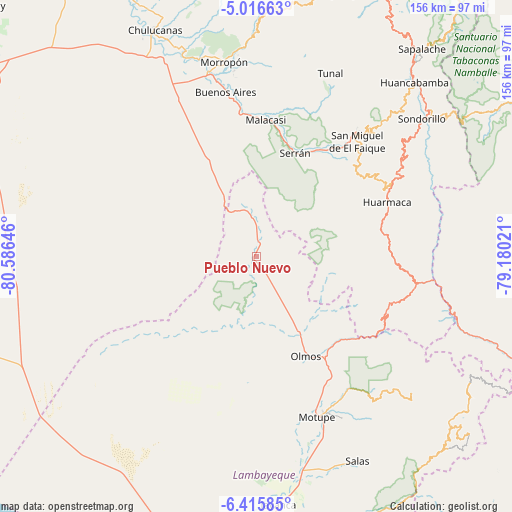
Pueblo Nuevo GPS coordinates[2]
5° 43' 0.012" South, 79° 52' 59.988" West
| Map corner | latitude | longitude |
|---|---|---|
| Upper-left | -5.01663°, | -80.58646° |
| Center: | -5.71667°, | -79.88333° |
| Lower-right: | -6.41585°, | -79.18021° |
| Map W x H: | 155.6×155.6 km | = 96.7×96.7mi |
| max Lat: | -0.96667° ⇑8% North |
| Pueblo Nuevo: | -5.71667° |
| min Lat: | ⇓92% South -18.01465° |
| min Long | Pueblo Nuevo | max Long |
| -81.30472° | -79.88333° | -69.04167° |
| W 4%⇐ | ⇒96% E |
Elevation
Elevation of Pueblo Nuevo is 170 m = 558 ft, and this is 2148.7 m = 7050 ft below average elevation for this country.
| Max E: |
5022 m = 16476 ft | 85.4% |
| Avg. | 2318.7 m = 7607 ft | |
| Pueblo Nuevo | 170 m = 558 ft | |
Min E: |
1 m = 3 ft | 14.6% |
See also: Peru elevation on elevation.city.
Geographical zone
Pueblo Nuevo is located in South Torrid zone (between Equator and Tropic of Capricorn). Distance of Equator is 635.6 km =394.9 mi to North.| Distance of | km | miles | from Pueblo Nuevo |
|---|---|---|---|
| Equator | 635.6 | 394.9 | to North |
| Tropic Capricorn | 1970.3 | 1224.3 | to South |
| Antarctic Circle | 6765.5 | 4203.9 | to South |
| South Pole | 9371.4 | 5823.1 | to South |


Nearby cities:
15 places around Pueblo Nuevo: (largest is in red/bold)
• Buenos Aires
51.5 km =32 mi,  349°
349°
• Canchaque
49.4 km =30.7 mi,  39°
39°
• Huancabamba
71.6 km =44.5 mi, 42°
• Huarmaca
43.4 km =27 mi,  67°
67°
• Morropón
59.7 km =37.1 mi, 350°
• Motupe
51.9 km =32.2 mi,  158°
158°
• Olmos
33.5 km =20.8 mi,  152°
152°
• Paltashaco
68.6 km =42.6 mi,  0°
0°
• Salas
69.3 km =43.1 mi, 153°
• Sallique
63.4 km =39.4 mi,  83°
83°
• San Felipe
63.5 km =39.5 mi,  95°
95°
• Sondor
69.3 km =43.1 mi,  49°
49°
• Sondorillo
65.4 km =40.6 mi, 50°
• Tunal
60.9 km =37.8 mi,  22°
22°
• Yamango
61.7 km =38.3 mi,  13°
13°
Sources, notices
• [Note1] Compared only with cities in Peru existing in our database
• [Src1] Map data: © OpenStreetMap contributors (CC-BY-SA)
• [Src2] Other city data from geonames.org with taken over terms of usage.
• [Src3] Geographical zone / Annual Mean Temperature by Robert A. Rohde @ Wikipedia
