Motupe geodata
Motupe (Lambayeque) is a seat of a third-order administrative division; located in Peru in America/Lima (GMT-5) time zone. With population of 13,681 people, there are 121 cities with bigger population in this country. Compared to other cities in Peru, 88.5% of cities are located further ↓South; 94.1% of cities are located further →East and 87.7% of cities have higher elevation than Motupe. Note1


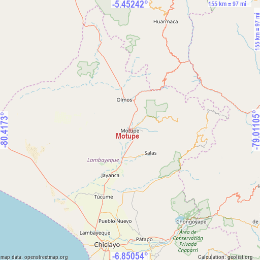
Motupe GPS coordinates[2]
6° 9' 6.984" South, 79° 42' 51.012" West
| Map corner | latitude | longitude |
|---|---|---|
| Upper-left | -5.45242°, | -80.4173° |
| Center: | -6.15194°, | -79.71417° |
| Lower-right: | -6.85054°, | -79.01105° |
| Map W x H: | 155.5×155.5 km | = 96.6×96.6mi |
| max Lat: | -0.96667° ⇑11.5% North |
| Motupe: | -6.15194° |
| min Lat: | ⇓88.5% South -18.01465° |
| min Long | Motupe | max Long |
| -81.30472° | -79.71417° | -69.04167° |
| W 5.9%⇐ | ⇒94.1% E |
Elevation
Elevation of Motupe is 135 m = 443 ft, and this is 2183.7 m = 7164 ft below average elevation for this country.
| Max E: |
5022 m = 16476 ft | 87.7% |
| Avg. | 2318.7 m = 7607 ft | |
| Motupe | 135 m = 443 ft | |
Min E: |
1 m = 3 ft | 12.3% |
See also: Peru elevation on elevation.city.
Geographical zone
Motupe is located in South Torrid zone (between Equator and Tropic of Capricorn). Distance of Equator is 684 km =425 mi to North.| Distance of | km | miles | from Motupe |
|---|---|---|---|
| Equator | 684 | 425 | to North |
| Tropic Capricorn | 1921.9 | 1194.2 | to South |
| Antarctic Circle | 6717.1 | 4173.8 | to South |
| South Pole | 9323 | 5793 | to South |


Nearby cities:
15 places around Motupe: (largest is in red/bold)
• Cañaris
51.1 km =31.8 mi,  76°
76°
• Ferreñafe
54.8 km =34.1 mi,  188°
188°
• Incahuasi
44.9 km =27.9 mi,  101°
101°
• Jayanca
29.1 km =18.1 mi,  204°
204°
• Manuel Antonio Mesones Muro
54.7 km =34 mi,  182°
182°
• Miracosta
55.2 km =34.3 mi,  120°
120°
• Mochumí
46.5 km =28.9 mi, 200°
• Mórrope
53.8 km =33.4 mi,  217°
217°
• Olmos
18.9 km =11.7 mi,  349°
349°
• Pacora
33.7 km =20.9 mi, 204°
• Pomahuaca
59.4 km =36.9 mi,  65°
65°
• Pueblo Nuevo
51.9 km =32.2 mi,  338°
338°
• Salas
18.3 km =11.4 mi,  138°
138°
• Tocmoche
48.5 km =30.1 mi,  126°
126°
• Túcume
42.5 km =26.4 mi, 201°
Sources, notices
• [Note1] Compared only with cities in Peru existing in our database
• [Src1] Map data: © OpenStreetMap contributors (CC-BY-SA)
• [Src2] Other city data from geonames.org with taken over terms of usage.
• [Src3] Geographical zone / Annual Mean Temperature by Robert A. Rohde @ Wikipedia
