Huarmaca geodata
Huarmaca (Piura) is a seat of a third-order administrative division; located in Peru in America/Lima (GMT-5) time zone. In our database, there are 305 cities with bigger population. Compared to other cities in Peru, 92.7% of cities are located further ↓South; 93.5% of cities are located further →East and 63.3% of cities have higher elevation than Huarmaca. Note1


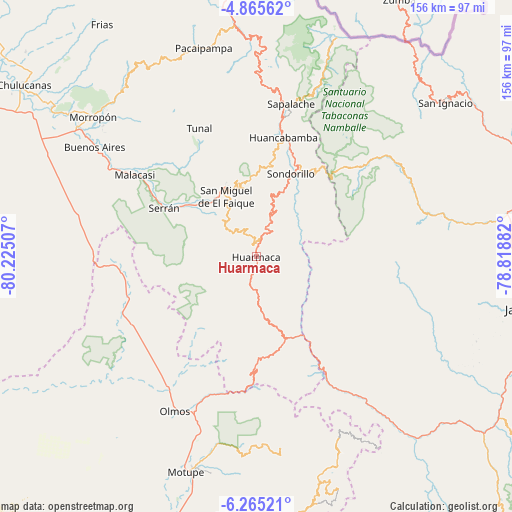
Huarmaca GPS coordinates[2]
5° 33' 56.988" South, 79° 31' 18.984" West
| Map corner | latitude | longitude |
|---|---|---|
| Upper-left | -4.86562°, | -80.22507° |
| Center: | -5.56583°, | -79.52194° |
| Lower-right: | -6.26521°, | -78.81882° |
| Map W x H: | 155.6×155.6 km | = 96.7×96.7mi |
| max Lat: | -0.96667° ⇑7.3% North |
| Huarmaca: | -5.56583° |
| min Lat: | ⇓92.7% South -18.01465° |
| min Long | Huarmaca | max Long |
| -81.30472° | -79.52194° | -69.04167° |
| W 6.5%⇐ | ⇒93.5% E |
Elevation
Elevation of Huarmaca is 2211 m = 7254 ft, and this is 107.7 m = 353 ft below average elevation for this country.
| Max E: |
5022 m = 16476 ft | 63.3% |
| Avg. | 2318.7 m = 7607 ft | |
| Huarmaca | 2211 m = 7254 ft | |
Min E: |
1 m = 3 ft | 36.7% |
See also: Peru elevation on elevation.city.
Geographical zone
Huarmaca is located in South Torrid zone (between Equator and Tropic of Capricorn). Distance of Equator is 618.9 km =384.6 mi to North.| Distance of | km | miles | from Huarmaca |
|---|---|---|---|
| Equator | 618.9 | 384.6 | to North |
| Tropic Capricorn | 1987.1 | 1234.7 | to South |
| Antarctic Circle | 6782.3 | 4214.3 | to South |
| South Pole | 9388.2 | 5833.6 | to South |


Nearby cities:
15 places around Huarmaca: (largest is in red/bold)
• Buenos Aires
59.6 km =37 mi,  304°
304°
• Canchaque
23.1 km =14.4 mi,  337°
337°
• Cañaris
60.5 km =37.6 mi,  151°
151°
• Huancabamba
37.2 km =23.1 mi,  12°
12°
• Olmos
52.7 km =32.7 mi,  207°
207°
• Pomahuaca
51.9 km =32.2 mi,  140°
140°
• Pueblo Nuevo
43.4 km =27 mi,  247°
247°
• Sallique
25.1 km =15.6 mi,  113°
113°
• San Felipe
32.3 km =20.1 mi,  133°
133°
• Sapalache
47.1 km =29.3 mi, 11°
• Sondor
31 km =19.3 mi,  24°
24°
• Sondorillo
27.2 km =16.9 mi, 21°
• Tabaconas
38.5 km =23.9 mi,  43°
43°
• Tunal
43.1 km =26.8 mi, 336°
• Yamango
50 km =31.1 mi,  329°
329°
Sources, notices
• [Note1] Compared only with cities in Peru existing in our database
• [Src1] Map data: © OpenStreetMap contributors (CC-BY-SA)
• [Src2] Other city data from geonames.org with taken over terms of usage.
• [Src3] Geographical zone / Annual Mean Temperature by Robert A. Rohde @ Wikipedia
