Olmos geodata
Olmos (Lambayeque) is a seat of a third-order administrative division; located in Peru in America/Lima (GMT-5) time zone. With population of 9,800 people, there are 145 cities with bigger population in this country. Compared to other cities in Peru, 90.3% of cities are located further ↓South; 94.3% of cities are located further →East and 85% of cities have higher elevation than Olmos. Note1


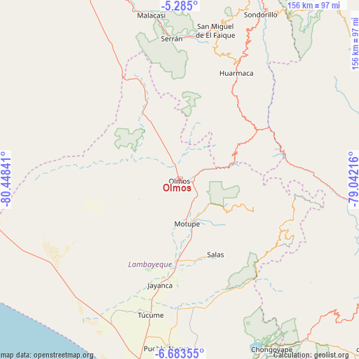
Olmos GPS coordinates[2]
5° 59' 4.992" South, 79° 44' 43.008" West
| Map corner | latitude | longitude |
|---|---|---|
| Upper-left | -5.285°, | -80.44841° |
| Center: | -5.98472°, | -79.74528° |
| Lower-right: | -6.68355°, | -79.04216° |
| Map W x H: | 155.5×155.5 km | = 96.6×96.6mi |
| max Lat: | -0.96667° ⇑9.7% North |
| Olmos: | -5.98472° |
| min Lat: | ⇓90.3% South -18.01465° |
| min Long | Olmos | max Long |
| -81.30472° | -79.74528° | -69.04167° |
| W 5.7%⇐ | ⇒94.3% E |
Elevation
Elevation of Olmos is 175 m = 574 ft, and this is 2143.7 m = 7033 ft below average elevation for this country.
| Max E: |
5022 m = 16476 ft | 85% |
| Avg. | 2318.7 m = 7607 ft | |
| Olmos | 175 m = 574 ft | |
Min E: |
1 m = 3 ft | 15% |
See also: Peru elevation on elevation.city.
Geographical zone
Olmos is located in South Torrid zone (between Equator and Tropic of Capricorn). Distance of Equator is 665.4 km =413.5 mi to North.| Distance of | km | miles | from Olmos |
|---|---|---|---|
| Equator | 665.4 | 413.5 | to North |
| Tropic Capricorn | 1940.5 | 1205.8 | to South |
| Antarctic Circle | 6735.7 | 4185.4 | to South |
| South Pole | 9341.6 | 5804.6 | to South |


Nearby cities:
15 places around Olmos: (largest is in red/bold)
• Cañaris
53.6 km =33.3 mi,  97°
97°
• Huarmaca
52.7 km =32.7 mi,  27°
27°
• Incahuasi
55 km =34.2 mi,  120°
120°
• Jayanca
45.9 km =28.5 mi,  190°
190°
• Mochumí
63.5 km =39.5 mi, 191°
• Motupe
18.9 km =11.7 mi,  169°
169°
• Mórrope
67.9 km =42.2 mi,  205°
205°
• Pacora
50.5 km =31.4 mi, 191°
• Pomahuaca
57.8 km =35.9 mi,  83°
83°
• Pueblo Nuevo
33.5 km =20.8 mi,  332°
332°
• Salas
35.8 km =22.2 mi,  154°
154°
• Sallique
60.2 km =37.4 mi,  52°
52°
• San Felipe
53.7 km =33.4 mi,  63°
63°
• Tocmoche
63.7 km =39.6 mi,  138°
138°
• Túcume
59.3 km =36.8 mi, 192°
Sources, notices
• [Note1] Compared only with cities in Peru existing in our database
• [Src1] Map data: © OpenStreetMap contributors (CC-BY-SA)
• [Src2] Other city data from geonames.org with taken over terms of usage.
• [Src3] Geographical zone / Annual Mean Temperature by Robert A. Rohde @ Wikipedia
