Pamparomas geodata
Pamparomas (Ancash) is a seat of a third-order administrative division; located in Peru in America/Lima (GMT-5) time zone. In our database, there are 305 cities with bigger population. Compared to other cities in Peru, 68.5% of cities are located further ↓South; 81% of cities are located further →East and 52.5% of cities have higher elevation than Pamparomas. Note1


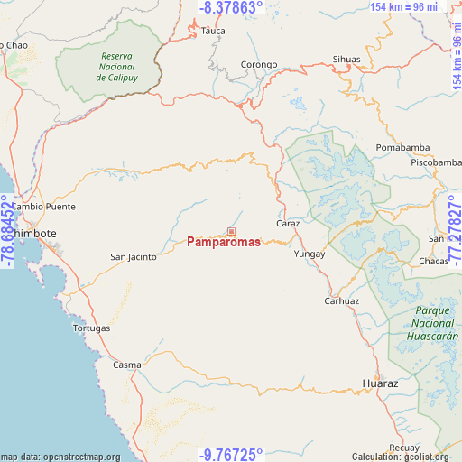
Pamparomas GPS coordinates[2]
9° 4' 24.996" South, 77° 58' 53.004" West
| Map corner | latitude | longitude |
|---|---|---|
| Upper-left | -8.37863°, | -78.68452° |
| Center: | -9.07361°, | -77.98139° |
| Lower-right: | -9.76725°, | -77.27827° |
| Map W x H: | 154.4×154.4 km | = 95.9×95.9mi |
| max Lat: | -0.96667° ⇑31.5% North |
| Pamparomas: | -9.07361° |
| min Lat: | ⇓68.5% South -18.01465° |
| min Long | Pamparomas | max Long |
| -81.30472° | -77.98139° | -69.04167° |
| W 19%⇐ | ⇒81% E |
Elevation
Elevation of Pamparomas is 2755 m = 9039 ft, and this is 436.3 m = 1431 ft above average elevation for this country.
| Max E: |
5022 m = 16476 ft | 52.5% |
| Pamparomas | 2755 m 9039 ft | |
| Avg. | 2318.7 m = 7607 ft | |
Min E: |
1 m = 3 ft | 47.5% |
See also: Peru elevation on elevation.city.
Geographical zone
Pamparomas is located in South Torrid zone (between Equator and Tropic of Capricorn). Distance of Equator is 1008.9 km =626.9 mi to North.| Distance of | km | miles | from Pamparomas |
|---|---|---|---|
| Equator | 1008.9 | 626.9 | to North |
| Tropic Capricorn | 1597 | 992.3 | to South |
| Antarctic Circle | 6392.3 | 3972 | to South |
| South Pole | 8998.2 | 5591.2 | to South |


Nearby cities:
15 places around Pamparomas: (largest is in red/bold)
• Carhuac
38 km =23.6 mi,  123°
123°
• Carás
19.2 km =11.9 mi,  81°
81°
• Cascapara
33.7 km =20.9 mi, 120°
• Huallanca
31.2 km =19.4 mi,  23°
23°
• Huaripampa
21.3 km =13.2 mi,  49°
49°
• Huata
14.7 km =9.1 mi,  64°
64°
• Macate
35.9 km =22.3 mi,  341°
341°
• Mancos
32.2 km =20 mi,  113°
113°
• Matacoto
28 km =17.4 mi, 114°
• Moro
23.2 km =14.4 mi,  251°
251°
• Quillo
29.2 km =18.1 mi,  193°
193°
• Ranrahirca
30.5 km =19 mi, 110°
• Shupluy
35.4 km =22 mi, 116°
• Sucre
19.9 km =12.4 mi, 46°
• Yungay
27.1 km =16.8 mi, 105°
Sources, notices
• [Note1] Compared only with cities in Peru existing in our database
• [Src1] Map data: © OpenStreetMap contributors (CC-BY-SA)
• [Src2] Other city data from geonames.org with taken over terms of usage.
• [Src3] Geographical zone / Annual Mean Temperature by Robert A. Rohde @ Wikipedia
