La Esperanza geodata
La Esperanza (La Libertad) is a seat of a third-order administrative division; located in Peru in America/Lima (GMT-5) time zone. In our database, there are 305 cities with bigger population. Compared to other cities in Peru, 73.7% of cities are located further ↓South; 90.6% of cities are located further →East and 89.3% of cities have higher elevation than La Esperanza. Note1
Administrative division(s):
- Level 1: La Libertad
- Level 2: Provincia de Trujillo
- Level 3: La Esperanza


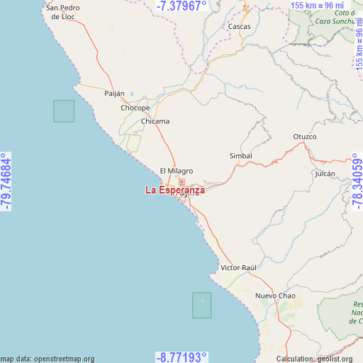
La Esperanza GPS coordinates[2]
8° 4' 35.04" South, 79° 2' 37.356" West
| Map corner | latitude | longitude |
|---|---|---|
| Upper-left | -7.37967°, | -79.74684° |
| Center: | -8.0764°, | -79.04371° |
| Lower-right: | -8.77193°, | -78.34059° |
| Map W x H: | 154.8×154.8 km | = 96.2×96.2mi |
| max Lat: | -0.96667° ⇑26.3% North |
| La Esperanza: | -8.0764° |
| min Lat: | ⇓73.7% South -18.01465° |
| min Long | La Esperanza | max Long |
| -81.30472° | -79.04371° | -69.04167° |
| W 9.4%⇐ | ⇒90.6% E |
Elevation
Elevation of La Esperanza is 101 m = 331 ft, and this is 2217.7 m = 7276 ft below average elevation for this country.
| Max E: |
5022 m = 16476 ft | 89.3% |
| Avg. | 2318.7 m = 7607 ft | |
| La Esperanza | 101 m = 331 ft | |
Min E: |
1 m = 3 ft | 10.7% |
See also: Peru elevation on elevation.city.
Geographical zone
La Esperanza is located in South Torrid zone (between Equator and Tropic of Capricorn). Distance of Equator is 898 km =558 mi to North.| Distance of | km | miles | from La Esperanza |
|---|---|---|---|
| Equator | 898 | 558 | to North |
| Tropic Capricorn | 1707.9 | 1061.2 | to South |
| Antarctic Circle | 6503.2 | 4040.9 | to South |
| South Pole | 9109.1 | 5660.1 | to South |


Nearby cities:
15 places around La Esperanza: (largest is in red/bold)
• Buenos Aires
6.9 km =4.3 mi,  176°
176°
• Casa Grande
40.2 km =25 mi,  336°
336°
• Chicama
28.2 km =17.5 mi, 336°
• Chocope
37.3 km =23.2 mi,  328°
328°
• El Porvenir
4.9 km =3 mi,  99°
99°
• Huanchaco
8.1 km =5 mi,  264°
264°
• La Cuesta
40.2 km =25 mi,  63°
63°
• Laredo
9.3 km =5.8 mi, 99°
• Moche
11.2 km =7 mi,  160°
160°
• Poroto
31.2 km =19.4 mi,  76°
76°
• Salaverry
17.7 km =11 mi, 155°
• Santiago de Cao
25.2 km =15.7 mi,  301°
301°
• Simbal
27.7 km =17.2 mi,  66°
66°
• Sinsicap
40.8 km =25.4 mi,  48°
48°
• Trujillo
4.7 km =2.9 mi, 161°
Sources, notices
• [Note1] Compared only with cities in Peru existing in our database
• [Src1] Map data: © OpenStreetMap contributors (CC-BY-SA)
• [Src2] Other city data from geonames.org with taken over terms of usage.
• [Src3] Geographical zone / Annual Mean Temperature by Robert A. Rohde @ Wikipedia
