Casma geodata
Casma (Ancash) is a seat of a third-order administrative division; located in Peru in America/Lima (GMT-5) time zone. In our database, there are 305 cities with bigger population. Compared to other cities in Peru, 64.8% of cities are located further ↓South; 84.1% of cities are located further →East and 92.9% of cities have higher elevation than Casma. Note1


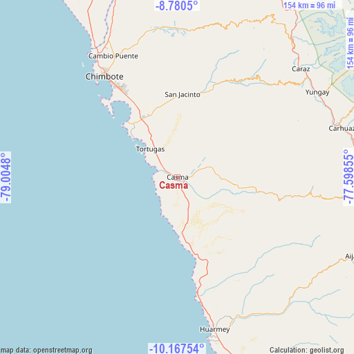
Casma GPS coordinates[2]
9° 28' 28.992" South, 78° 18' 6.012" West
| Map corner | latitude | longitude |
|---|---|---|
| Upper-left | -8.7805°, | -79.0048° |
| Center: | -9.47472°, | -78.30167° |
| Lower-right: | -10.16754°, | -77.59855° |
| Map W x H: | 154.2×154.2 km | = 95.8×95.8mi |
| max Lat: | -0.96667° ⇑35.2% North |
| Casma: | -9.47472° |
| min Lat: | ⇓64.8% South -18.01465° |
| min Long | Casma | max Long |
| -81.30472° | -78.30167° | -69.04167° |
| W 15.9%⇐ | ⇒84.1% E |
Elevation
Elevation of Casma is 49 m = 161 ft, and this is 2269.7 m = 7447 ft below average elevation for this country.
| Max E: |
5022 m = 16476 ft | 92.9% |
| Avg. | 2318.7 m = 7607 ft | |
| Casma | 49 m = 161 ft | |
Min E: |
1 m = 3 ft | 7.1% |
See also: Peru elevation on elevation.city.
Geographical zone
Casma is located in South Torrid zone (between Equator and Tropic of Capricorn). Distance of Equator is 1053.5 km =654.6 mi to North.| Distance of | km | miles | from Casma |
|---|---|---|---|
| Equator | 1053.5 | 654.6 | to North |
| Tropic Capricorn | 1552.4 | 964.6 | to South |
| Antarctic Circle | 6347.7 | 3944.3 | to South |
| South Pole | 8953.6 | 5563.5 | to South |


Nearby cities:
15 places around Casma: (largest is in red/bold)
• Buenos Aires
44.5 km =27.7 mi,  331°
331°
• Cajamarquilla
63 km =39.1 mi,  106°
106°
• Chimbote
52.9 km =32.9 mi,  324°
324°
• Cochabamba
48.5 km =30.1 mi,  92°
92°
• Coishco
60.9 km =37.8 mi, 325°
• Colcabamba
54.5 km =33.9 mi,  102°
102°
• Huanchay
58.8 km =36.5 mi,  119°
119°
• La Caleta Culebras
53.4 km =33.2 mi,  170°
170°
• Moro
39.6 km =24.6 mi,  19°
19°
• Nepeña
34.2 km =21.3 mi,  349°
349°
• Pamparomas
56.8 km =35.3 mi,  38°
38°
• Pampas
55.6 km =34.5 mi, 112°
• Puerto Casma
9 km =5.6 mi,  277°
277°
• Quillo
32.8 km =20.4 mi,  60°
60°
• Samanco
31.9 km =19.8 mi, 317°
Sources, notices
• [Note1] Compared only with cities in Peru existing in our database
• [Src1] Map data: © OpenStreetMap contributors (CC-BY-SA)
• [Src2] Other city data from geonames.org with taken over terms of usage.
• [Src3] Geographical zone / Annual Mean Temperature by Robert A. Rohde @ Wikipedia
