Cachachi geodata
Cachachi (Cajamarca) is a seat of a third-order administrative division; located in Peru in America/Lima (GMT-5) time zone. In our database, there are 305 cities with bigger population. Compared to other cities in Peru, 76.3% of cities are located further ↓South; 83.9% of cities are located further →East and 81% of cities have lower elevation than Cachachi. Note1


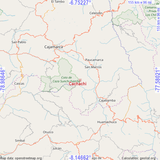
Cachachi GPS coordinates[2]
7° 27' 0" South, 78° 16' 59.988" West
| Map corner | latitude | longitude |
|---|---|---|
| Upper-left | -6.75227°, | -78.98646° |
| Center: | -7.45°, | -78.28333° |
| Lower-right: | -8.14662°, | -77.58021° |
| Map W x H: | 155×155 km | = 96.3×96.3mi |
| max Lat: | -0.96667° ⇑23.7% North |
| Cachachi: | -7.45° |
| min Lat: | ⇓76.3% South -18.01465° |
| min Long | Cachachi | max Long |
| -81.30472° | -78.28333° | -69.04167° |
| W 16.1%⇐ | ⇒83.9% E |
Elevation
Elevation of Cachachi is 3550 m = 11647 ft, and this is 1231.3 m = 4040 ft above average elevation for this country.
| Max E: |
5022 m = 16476 ft | 19% |
| Cachachi | 3550 m 11647 ft | |
| Avg. | 2318.7 m = 7607 ft | |
Min E: |
1 m = 3 ft | 81% |
See also: Peru elevation on elevation.city.
Geographical zone
Cachachi is located in South Torrid zone (between Equator and Tropic of Capricorn). Distance of Equator is 828.4 km =514.7 mi to North.| Distance of | km | miles | from Cachachi |
|---|---|---|---|
| Equator | 828.4 | 514.7 | to North |
| Tropic Capricorn | 1777.6 | 1104.5 | to South |
| Antarctic Circle | 6572.8 | 4084.1 | to South |
| South Pole | 9178.7 | 5703.4 | to South |


Nearby cities:
15 places around Cachachi: (largest is in red/bold)
• Cajabamba
31.7 km =19.7 mi,  125°
125°
• Cajamarca
39.8 km =24.7 mi,  323°
323°
• Cauday
26.6 km =16.5 mi,  123°
123°
• Encañada
41.4 km =25.7 mi,  349°
349°
• Huaranchal
31.8 km =19.8 mi,  215°
215°
• La Grama
16.6 km =10.3 mi,  96°
96°
• Llacanora
32.3 km =20.1 mi,  329°
329°
• Lluchubamba
35.4 km =22 mi, 103°
• Lucma
35.8 km =22.2 mi,  235°
235°
• Marcabal
39.1 km =24.3 mi,  135°
135°
• Namora
28.3 km =17.6 mi, 348°
• San Juan
29.1 km =18.1 mi,  304°
304°
• San Marcos
17 km =10.6 mi,  40°
40°
• Sayapullo
26.2 km =16.3 mi,  230°
230°
• Shirac
28 km =17.4 mi,  66°
66°
Sources, notices
• [Note1] Compared only with cities in Peru existing in our database
• [Src1] Map data: © OpenStreetMap contributors (CC-BY-SA)
• [Src2] Other city data from geonames.org with taken over terms of usage.
• [Src3] Geographical zone / Annual Mean Temperature by Robert A. Rohde @ Wikipedia
