Bernal geodata
Bernal (Piura) is a seat of a third-order administrative division; located in Peru in America/Lima (GMT-5) time zone. With population of 5,916 people, there are 210 cities with bigger population in this country. Compared to other cities in Peru, 93% of cities are located further ↓South; 98.5% of cities are located further →East and 98.1% of cities have higher elevation than Bernal. Note1


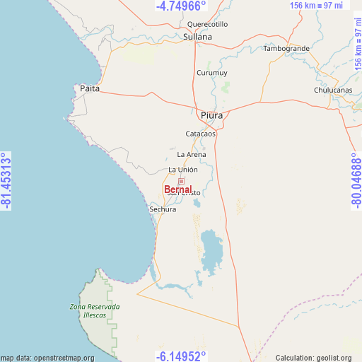
Bernal GPS coordinates[2]
5° 27' 0" South, 80° 45' 0" West
| Map corner | latitude | longitude |
|---|---|---|
| Upper-left | -4.74966°, | -81.45313° |
| Center: | -5.45°, | -80.75° |
| Lower-right: | -6.14952°, | -80.04688° |
| Map W x H: | 155.6×155.7 km | = 96.7×96.7mi |
| max Lat: | -0.96667° ⇑7% North |
| Bernal: | -5.45° |
| min Lat: | ⇓93% South -18.01465° |
| min Long | Bernal | max Long |
| -81.30472° | -80.75° | -69.04167° |
| W 1.5%⇐ | ⇒98.5% E |
Elevation
Elevation of Bernal is 13 m = 43 ft, and this is 2305.7 m = 7565 ft below average elevation for this country.
| Max E: |
5022 m = 16476 ft | 98.1% |
| Avg. | 2318.7 m = 7607 ft | |
| Bernal | 13 m = 43 ft | |
Min E: |
1 m = 3 ft | 1.9% |
See also: Peru elevation on elevation.city.
Geographical zone
Bernal is located in South Torrid zone (between Equator and Tropic of Capricorn). Distance of Equator is 606 km =376.6 mi to North.| Distance of | km | miles | from Bernal |
|---|---|---|---|
| Equator | 606 | 376.6 | to North |
| Tropic Capricorn | 1999.9 | 1242.7 | to South |
| Antarctic Circle | 6795.2 | 4222.3 | to South |
| South Pole | 9401.1 | 5841.6 | to South |


Nearby cities:
15 places around Bernal: (largest is in red/bold)
• Catacaos
21.7 km =13.5 mi,  19°
19°
• Dos Pueblos
1.8 km =1.1 mi,  270°
270°
• La Arena
13.1 km =8.1 mi,  8°
8°
• La Huaca
64.2 km =39.9 mi,  338°
338°
• La Unión
5.4 km =3.4 mi, 9°
• Marcavelica
63.8 km =39.6 mi,  4°
4°
• Paita
56.9 km =35.4 mi,  314°
314°
• Piura
31.2 km =19.4 mi, 24°
• Salinera Colán
58.1 km =36.1 mi,  322°
322°
• Salitral
66.4 km =41.3 mi, 6°
• Sechura
14.3 km =8.9 mi,  213°
213°
• Sinchao
9.9 km =6.2 mi,  68°
68°
• Sojo
61.5 km =38.2 mi,  353°
353°
• Sullana
61.1 km =38 mi, 6°
• Vice
5.2 km =3.2 mi, 315°
Sources, notices
• [Note1] Compared only with cities in Peru existing in our database
• [Src1] Map data: © OpenStreetMap contributors (CC-BY-SA)
• [Src2] Other city data from geonames.org with taken over terms of usage.
• [Src3] Geographical zone / Annual Mean Temperature by Robert A. Rohde @ Wikipedia
