Totos geodata
Totos (Ayacucho) is a seat of a third-order administrative division; located in Peru in America/Lima (GMT-5) time zone. In our database, there are 305 cities with bigger population. Compared to other cities in Peru, 67.6% of cities are located further ↑North; 61.9% of cities are located further ←West and 68.2% of cities have lower elevation than Totos. Note1


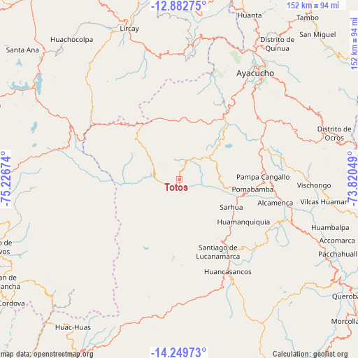
Totos GPS coordinates[2]
13° 34' 1.992" South, 74° 31' 24.996" West
| Map corner | latitude | longitude |
|---|---|---|
| Upper-left | -12.88275°, | -75.22674° |
| Center: | -13.56722°, | -74.52361° |
| Lower-right: | -14.24973°, | -73.82049° |
| Map W x H: | 152×152 km | = 94.4×94.4mi |
| max Lat: | -0.96667° ⇑67.6% North |
| Totos: | -13.56722° |
| min Lat: | ⇓32.4% South -18.01465° |
| min Long | Totos | max Long |
| -81.30472° | -74.52361° | -69.04167° |
| W 61.9%⇐ | ⇒38.1% E |
Elevation
Elevation of Totos is 3308 m = 10853 ft, and this is 989.3 m = 3246 ft above average elevation for this country.
| Max E: |
5022 m = 16476 ft | 31.8% |
| Totos | 3308 m 10853 ft | |
| Avg. | 2318.7 m = 7607 ft | |
Min E: |
1 m = 3 ft | 68.2% |
See also: Peru elevation on elevation.city.
Geographical zone
Totos is located in South Torrid zone (between Equator and Tropic of Capricorn). Distance of this Southern Tropic circle is 1097.4 km =681.9 mi to South.| Distance of | km | miles | from Totos |
|---|---|---|---|
| Equator | 1508.5 | 937.3 | to North |
| Tropic Capricorn | 1097.4 | 681.9 | to South |
| Antarctic Circle | 5892.6 | 3661.5 | to South |
| South Pole | 8498.5 | 5280.7 | to South |


Nearby cities:
15 places around Totos: (largest is in red/bold)
• Cangallo
41.6 km =25.8 mi,  99°
99°
• Carapo
37.9 km =23.5 mi,  142°
142°
• Carmen Alto
53.6 km =33.3 mi,  37°
37°
• Chiara
47.6 km =29.6 mi,  46°
46°
• Chuschi
18.8 km =11.7 mi, 96°
• Huamanquiquia
32.6 km =20.3 mi,  123°
123°
• Huancapi
53.7 km =33.4 mi,  113°
113°
• Pampa Cangallo
35.5 km =22.1 mi,  88°
88°
• Pomabamba
31.4 km =19.5 mi, 97°
• Sacsamarca
48 km =29.8 mi,  151°
151°
• Sarhua
25 km =15.5 mi, 118°
• Socos
46.7 km =29 mi,  32°
32°
• Ticllas
52.6 km =32.7 mi,  23°
23°
• Vilcanchos
5 km =3.1 mi,  190°
190°
• Vinchos
40.7 km =25.3 mi, 26°
Sources, notices
• [Note1] Compared only with cities in Peru existing in our database
• [Src1] Map data: © OpenStreetMap contributors (CC-BY-SA)
• [Src2] Other city data from geonames.org with taken over terms of usage.
• [Src3] Geographical zone / Annual Mean Temperature by Robert A. Rohde @ Wikipedia
