Taurisma geodata
Taurisma (Arequipa) is a seat of a third-order administrative division; located in Peru in America/Lima (GMT-5) time zone. In our database, there are 305 cities with bigger population. Compared to other cities in Peru, 86.5% of cities are located further ↑North; 75% of cities are located further ←West and 56.9% of cities have higher elevation than Taurisma. Note1


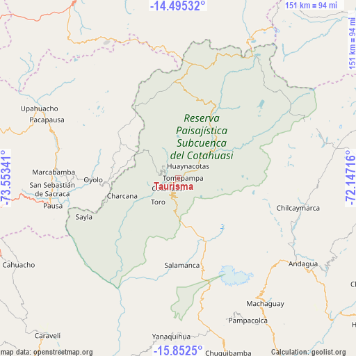
Taurisma GPS coordinates[2]
15° 10' 30" South, 72° 51' 1.008" West
| Map corner | latitude | longitude |
|---|---|---|
| Upper-left | -14.49532°, | -73.55341° |
| Center: | -15.175°, | -72.85028° |
| Lower-right: | -15.8525°, | -72.14716° |
| Map W x H: | 150.9×150.9 km | = 93.8×93.8mi |
| max Lat: | -0.96667° ⇑86.5% North |
| Taurisma: | -15.175° |
| min Lat: | ⇓13.5% South -18.01465° |
| min Long | Taurisma | max Long |
| -81.30472° | -72.85028° | -69.04167° |
| W 75%⇐ | ⇒25% E |
Elevation
Elevation of Taurisma is 2596 m = 8517 ft, and this is 277.3 m = 910 ft above average elevation for this country.
| Max E: |
5022 m = 16476 ft | 56.9% |
| Taurisma | 2596 m 8517 ft | |
| Avg. | 2318.7 m = 7607 ft | |
Min E: |
1 m = 3 ft | 43.1% |
See also: Peru elevation on elevation.city.
Geographical zone
Taurisma is located in South Torrid zone (between Equator and Tropic of Capricorn). Distance of this Southern Tropic circle is 918.6 km =570.8 mi to South.| Distance of | km | miles | from Taurisma |
|---|---|---|---|
| Equator | 1687.3 | 1048.4 | to North |
| Tropic Capricorn | 918.6 | 570.8 | to South |
| Antarctic Circle | 5713.9 | 3550.5 | to South |
| South Pole | 8319.8 | 5169.7 | to South |


Nearby cities:
15 places around Taurisma: (largest is in red/bold)
• Alca
10.2 km =6.3 mi,  63°
63°
• Charcana
24.8 km =15.4 mi,  252°
252°
• Chichas
42.1 km =26.2 mi,  190°
190°
• Colta
47.7 km =29.6 mi,  271°
271°
• Corculla
38.8 km =24.1 mi,  255°
255°
• Cotahuasi
5.9 km =3.7 mi,  224°
224°
• Lampa
53.5 km =33.2 mi, 268°
• Marcabamba
52.8 km =32.8 mi, 272°
• Mungui
6 km =3.7 mi, 261°
• Oyolo
36 km =22.4 mi, 269°
• Puyca
21.4 km =13.3 mi,  53°
53°
• Tauria
45.7 km =28.4 mi,  243°
243°
• Tomepampa
2.1 km =1.3 mi,  84°
84°
• Toro
13 km =8.1 mi, 220°
• Velinga
21.4 km =13.3 mi, 239°
Sources, notices
• [Note1] Compared only with cities in Peru existing in our database
• [Src1] Map data: © OpenStreetMap contributors (CC-BY-SA)
• [Src2] Other city data from geonames.org with taken over terms of usage.
• [Src3] Geographical zone / Annual Mean Temperature by Robert A. Rohde @ Wikipedia
