Moquegua geodata
Moquegua is a seat of a first-order administrative division; located in Peru in America/Lima (GMT-5) time zone. With population of 54,517 people, there are 34 cities with bigger population in this country. Compared to other cities in Peru, 97.8% of cities are located further ↑North; 90.2% of cities are located further ←West and 70% of cities have higher elevation than Moquegua. Note1
Administrative division(s):
- Level 1: Moquegua
- Level 2: Provincia de Mariscal Nieto
- Level 3: Moquegua


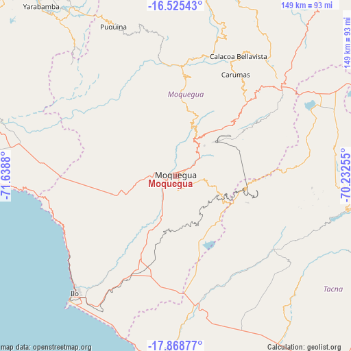
Moquegua GPS coordinates[2]
17° 11' 53.952" South, 70° 56' 8.412" West
| Map corner | latitude | longitude |
|---|---|---|
| Upper-left | -16.52543°, | -71.6388° |
| Center: | -17.19832°, | -70.93567° |
| Lower-right: | -17.86877°, | -70.23255° |
| Map W x H: | 149.4×149.4 km | = 92.8×92.8mi |
| max Lat: | -0.96667° ⇑97.8% North |
| Moquegua: | -17.19832° |
| min Lat: | ⇓2.2% South -18.01465° |
| min Long | Moquegua | max Long |
| -81.30472° | -70.93567° | -69.04167° |
| W 90.2%⇐ | ⇒9.8% E |
Elevation
Elevation of Moquegua is 1445 m = 4741 ft, and this is 873.7 m = 2866 ft below average elevation for this country.
| Max E: |
5022 m = 16476 ft | 70% |
| Avg. | 2318.7 m = 7607 ft | |
| Moquegua | 1445 m = 4741 ft | |
Min E: |
1 m = 3 ft | 30% |
See also: Moquegua elevation on elevation.city.
Geographical zone
Moquegua is located in South Torrid zone (between Equator and Tropic of Capricorn). Distance of this Southern Tropic circle is 693.6 km =431 mi to South.| Distance of | km | miles | from Moquegua |
|---|---|---|---|
| Equator | 1912.3 | 1188.2 | to North |
| Tropic Capricorn | 693.6 | 431 | to South |
| Antarctic Circle | 5488.9 | 3410.6 | to South |
| South Pole | 8094.8 | 5029.9 | to South |


Nearby cities:
15 places around Moquegua: (largest is in red/bold)
• Cairani
61.5 km =38.2 mi,  99°
99°
• Calacoa
55.8 km =34.7 mi,  26°
26°
• Camilaca
59.7 km =37.1 mi, 97°
• Carumas
48.4 km =30.1 mi, 28°
• Coalaque
61.6 km =38.3 mi,  351°
351°
• Cuchumbaya
56.6 km =35.2 mi, 28°
• El Algarrobal
58.9 km =36.6 mi,  216°
216°
• Ilabaya
51.2 km =31.8 mi,  118°
118°
• La Capilla
55.5 km =34.5 mi,  332°
332°
• Locumba
49.7 km =30.9 mi,  158°
158°
• Omate
57.5 km =35.7 mi, 354°
• Pujocucho
62.1 km =38.6 mi,  85°
85°
• Quinistaquillas
50.2 km =31.2 mi,  6°
6°
• Samegua
4.4 km =2.7 mi,  61°
61°
• Torata
16.7 km =10.4 mi,  36°
36°
Sources, notices
• [Note1] Compared only with cities in Peru existing in our database
• [Src1] Map data: © OpenStreetMap contributors (CC-BY-SA)
• [Src2] Other city data from geonames.org with taken over terms of usage.
• [Src3] Geographical zone / Annual Mean Temperature by Robert A. Rohde @ Wikipedia
