Guadalupe geodata
Guadalupe (Ica) is a seat of a third-order administrative division; located in Peru in America/Lima (GMT-5) time zone. In our database, there are 305 cities with bigger population. Compared to other cities in Peru, 73.4% of cities are located further ↑North; 50.6% of cities are located further →East and 78.7% of cities have higher elevation than Guadalupe. Note1


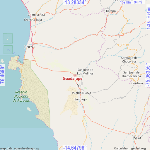
Guadalupe GPS coordinates[2]
13° 58' 0.012" South, 75° 46' 0.012" West
| Map corner | latitude | longitude |
|---|---|---|
| Upper-left | -13.28334°, | -76.4698° |
| Center: | -13.96667°, | -75.76667° |
| Lower-right: | -14.64798°, | -75.06355° |
| Map W x H: | 151.7×151.7 km | = 94.3×94.3mi |
| max Lat: | -0.96667° ⇑73.4% North |
| Guadalupe: | -13.96667° |
| min Lat: | ⇓26.6% South -18.01465° |
| min Long | Guadalupe | max Long |
| -81.30472° | -75.76667° | -69.04167° |
| W 49.4%⇐ | ⇒50.6% E |
Elevation
Elevation of Guadalupe is 432 m = 1417 ft, and this is 1886.7 m = 6190 ft below average elevation for this country.
| Max E: |
5022 m = 16476 ft | 78.7% |
| Avg. | 2318.7 m = 7607 ft | |
| Guadalupe | 432 m = 1417 ft | |
Min E: |
1 m = 3 ft | 21.3% |
See also: Peru elevation on elevation.city.
Geographical zone
Guadalupe is located in South Torrid zone (between Equator and Tropic of Capricorn). Distance of this Southern Tropic circle is 1053 km =654.3 mi to South.| Distance of | km | miles | from Guadalupe |
|---|---|---|---|
| Equator | 1552.9 | 964.9 | to North |
| Tropic Capricorn | 1053 | 654.3 | to South |
| Antarctic Circle | 5848.2 | 3633.9 | to South |
| South Pole | 8454.1 | 5253.1 | to South |


Nearby cities:
15 places around Guadalupe: (largest is in red/bold)
• Huancano
43.9 km =27.3 mi,  21°
21°
• Humay
31.3 km =19.4 mi,  332°
332°
• Ica
12 km =7.5 mi,  159°
159°
• Independencia
41.3 km =25.7 mi,  315°
315°
• La Tinguiña
10.5 km =6.5 mi,  137°
137°
• Los Aquijes
16.6 km =10.3 mi,  150°
150°
• Ocucaje
43.7 km =27.2 mi,  166°
166°
• Paracas
55.1 km =34.2 mi,  281°
281°
• Pueblo Nuevo
19.1 km =11.9 mi, 160°
• Rosario de Yauca
28 km =17.4 mi,  132°
132°
• San Clemente
53.2 km =33.1 mi,  308°
308°
• San Juan Bautista
5.9 km =3.7 mi, 145°
• Santiago
25 km =15.5 mi, 166°
• Subtanjalla
5.9 km =3.7 mi, 170°
• Villa Tupac Amaru
50.2 km =31.2 mi,  304°
304°
Sources, notices
• [Note1] Compared only with cities in Peru existing in our database
• [Src1] Map data: © OpenStreetMap contributors (CC-BY-SA)
• [Src2] Other city data from geonames.org with taken over terms of usage.
• [Src3] Geographical zone / Annual Mean Temperature by Robert A. Rohde @ Wikipedia
