San Juan Bautista geodata
San Juan Bautista (Ica) is a seat of a third-order administrative division; located in Peru in America/Lima (GMT-5) time zone. With population of 6,871 people, there are 187 cities with bigger population in this country. Compared to other cities in Peru, 74% of cities are located further ↑North; 50.1% of cities are located further →East and 78.9% of cities have higher elevation than San Juan Bautista. Note1


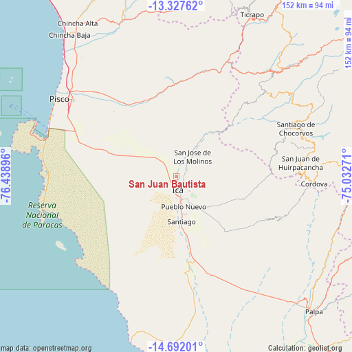
San Juan Bautista GPS coordinates[2]
14° 0' 38.988" South, 75° 44' 8.988" West
| Map corner | latitude | longitude |
|---|---|---|
| Upper-left | -13.32762°, | -76.43896° |
| Center: | -14.01083°, | -75.73583° |
| Lower-right: | -14.69201°, | -75.03271° |
| Map W x H: | 151.7×151.7 km | = 94.3×94.3mi |
| max Lat: | -0.96667° ⇑74% North |
| San Juan Bautista: | -14.01083° |
| min Lat: | ⇓26% South -18.01465° |
| min Long | San Juan Bautis | max Long |
| -81.30472° | -75.73583° | -69.04167° |
| W 49.9%⇐ | ⇒50.1% E |
Elevation
Elevation of San Juan Bautista is 427 m = 1401 ft, and this is 1891.7 m = 6206 ft below average elevation for this country.
| Max E: |
5022 m = 16476 ft | 78.9% |
| Avg. | 2318.7 m = 7607 ft | |
| San Juan Bautista | 427 m = 1401 ft | |
Min E: |
1 m = 3 ft | 21.1% |
See also: Peru elevation on elevation.city.
Geographical zone
San Juan Bautista is located in South Torrid zone (between Equator and Tropic of Capricorn). Distance of this Southern Tropic circle is 1048.1 km =651.3 mi to South.| Distance of | km | miles | from San Juan Bautista |
|---|---|---|---|
| Equator | 1557.9 | 968 | to North |
| Tropic Capricorn | 1048.1 | 651.3 | to South |
| Antarctic Circle | 5843.3 | 3630.9 | to South |
| South Pole | 8449.2 | 5250.1 | to South |


Nearby cities:
15 places around San Juan Bautista: (largest is in red/bold)
• Guadalupe
5.9 km =3.7 mi,  325°
325°
• Huancano
47.5 km =29.5 mi,  15°
15°
• Humay
37.2 km =23.1 mi, 331°
• Ica
6.4 km =4 mi,  172°
172°
• Independencia
47.2 km =29.3 mi,  317°
317°
• La Tinguiña
4.7 km =2.9 mi,  125°
125°
• Los Aquijes
10.7 km =6.6 mi,  153°
153°
• Ocucaje
38.2 km =23.7 mi, 169°
• Paracas
59.5 km =37 mi,  285°
285°
• Pueblo Nuevo
13.4 km =8.3 mi, 166°
• Rosario de Yauca
22.3 km =13.9 mi, 128°
• San Clemente
58.9 km =36.6 mi,  310°
310°
• Santiago
19.5 km =12.1 mi, 172°
• Subtanjalla
2.6 km =1.6 mi,  249°
249°
• Villa Tupac Amaru
55.7 km =34.6 mi, 306°
Sources, notices
• [Note1] Compared only with cities in Peru existing in our database
• [Src1] Map data: © OpenStreetMap contributors (CC-BY-SA)
• [Src2] Other city data from geonames.org with taken over terms of usage.
• [Src3] Geographical zone / Annual Mean Temperature by Robert A. Rohde @ Wikipedia
