Estique geodata
Estique (Tacna) is a seat of a third-order administrative division; located in Peru in America/Lima (GMT-5) time zone. In our database, there are 305 cities with bigger population. Compared to other cities in Peru, 99.1% of cities are located further ↑North; 96.4% of cities are located further ←West and 59.9% of cities have lower elevation than Estique. Note1


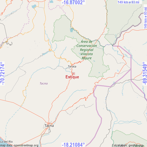
Estique GPS coordinates[2]
17° 32' 30.012" South, 70° 1' 6.996" West
| Map corner | latitude | longitude |
|---|---|---|
| Upper-left | -16.87002°, | -70.72174° |
| Center: | -17.54167°, | -70.01861° |
| Lower-right: | -18.21084°, | -69.31549° |
| Map W x H: | 149.1×149.1 km | = 92.6×92.6mi |
| max Lat: | -0.96667° ⇑99.1% North |
| Estique: | -17.54167° |
| min Lat: | ⇓0.9% South -18.01465° |
| min Long | Estique | max Long |
| -81.30472° | -70.01861° | -69.04167° |
| W 96.4%⇐ | ⇒3.6% E |
Elevation
Elevation of Estique is 3153 m = 10344 ft, and this is 834.3 m = 2737 ft above average elevation for this country.
| Max E: |
5022 m = 16476 ft | 40.1% |
| Estique | 3153 m 10344 ft | |
| Avg. | 2318.7 m = 7607 ft | |
Min E: |
1 m = 3 ft | 59.9% |
See also: Peru elevation on elevation.city.
Geographical zone
Estique is located in South Torrid zone (between Equator and Tropic of Capricorn). Distance of this Southern Tropic circle is 655.5 km =407.3 mi to South.| Distance of | km | miles | from Estique |
|---|---|---|---|
| Equator | 1950.5 | 1212 | to North |
| Tropic Capricorn | 655.5 | 407.3 | to South |
| Antarctic Circle | 5450.7 | 3386.9 | to South |
| South Pole | 8056.6 | 5006.1 | to South |


Nearby cities:
15 places around Estique: (largest is in red/bold)
• Cairani
46.4 km =28.8 mi,  307°
307°
• Candarave
39.1 km =24.3 mi,  321°
321°
• Chipispaya
21.6 km =13.4 mi,  283°
283°
• Chucatamani
12.9 km =8 mi,  301°
301°
• Chuquitira
28.2 km =17.5 mi,  354°
354°
• Curibaya
37.9 km =23.5 mi, 297°
• Huanuara
41 km =25.5 mi, 308°
• Palca
26.7 km =16.6 mi,  166°
166°
• Quilahuani
35.6 km =22.1 mi, 314°
• Sitajara
22.1 km =13.7 mi,  326°
326°
• Susapaya
24.2 km =15 mi, 330°
• Tarata
7.6 km =4.7 mi, 348°
• Tarucachi
2.1 km =1.3 mi, 331°
• Ticaco
11 km =6.8 mi,  344°
344°
• Totoral
39.7 km =24.7 mi,  292°
292°
Sources, notices
• [Note1] Compared only with cities in Peru existing in our database
• [Src1] Map data: © OpenStreetMap contributors (CC-BY-SA)
• [Src2] Other city data from geonames.org with taken over terms of usage.
• [Src3] Geographical zone / Annual Mean Temperature by Robert A. Rohde @ Wikipedia
