Ambar geodata
Ambar (Lima region) is a seat of a third-order administrative division; located in Peru in America/Lima (GMT-5) time zone. In our database, there are 305 cities with bigger population. Compared to other cities in Peru, 56.9% of cities are located further ↓South; 70% of cities are located further →East and 53.6% of cities have higher elevation than Ambar. Note1


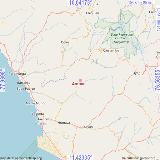
Ambar GPS coordinates[2]
10° 43' 59.988" South, 77° 16' 0.012" West
| Map corner | latitude | longitude |
|---|---|---|
| Upper-left | -10.04173°, | -77.9698° |
| Center: | -10.73333°, | -77.26667° |
| Lower-right: | -11.42335°, | -76.56355° |
| Map W x H: | 153.6×153.6 km | = 95.4×95.4mi |
| max Lat: | -0.96667° ⇑43.1% North |
| Ambar: | -10.73333° |
| min Lat: | ⇓56.9% South -18.01465° |
| min Long | Ambar | max Long |
| -81.30472° | -77.26667° | -69.04167° |
| W 30%⇐ | ⇒70% E |
Elevation
Elevation of Ambar is 2736 m = 8976 ft, and this is 417.3 m = 1369 ft above average elevation for this country.
| Max E: |
5022 m = 16476 ft | 53.6% |
| Ambar | 2736 m 8976 ft | |
| Avg. | 2318.7 m = 7607 ft | |
Min E: |
1 m = 3 ft | 46.4% |
See also: Peru elevation on elevation.city.
Geographical zone
Ambar is located in South Torrid zone (between Equator and Tropic of Capricorn). Distance of Equator is 1193.4 km =741.5 mi to North.| Distance of | km | miles | from Ambar |
|---|---|---|---|
| Equator | 1193.4 | 741.5 | to North |
| Tropic Capricorn | 1412.5 | 877.7 | to South |
| Antarctic Circle | 6207.7 | 3857.3 | to South |
| South Pole | 8813.6 | 5476.5 | to South |


Nearby cities:
15 places around Ambar: (largest is in red/bold)
• Acas
31.3 km =19.4 mi,  347°
347°
• Aco
26.4 km =16.4 mi,  5°
5°
• Andajes
39.6 km =24.6 mi,  99°
99°
• Canis
45.1 km =28 mi, 13°
• Caujul
32.4 km =20.1 mi, 104°
• Congas
48 km =29.8 mi,  336°
336°
• Copa
43.5 km =27 mi,  28°
28°
• Copa
46.9 km =29.1 mi,  329°
329°
• Gorgor
30.5 km =19 mi,  56°
56°
• Llipa
39.6 km =24.6 mi, 9°
• Mangas
43.8 km =27.2 mi,  24°
24°
• Ocros
39.4 km =24.5 mi, 338°
• Paccho
44.2 km =27.5 mi,  124°
124°
• Sayán
45.2 km =28.1 mi,  169°
169°
• Supe
49.3 km =30.6 mi,  261°
261°
Sources, notices
• [Note1] Compared only with cities in Peru existing in our database
• [Src1] Map data: © OpenStreetMap contributors (CC-BY-SA)
• [Src2] Other city data from geonames.org with taken over terms of usage.
• [Src3] Geographical zone / Annual Mean Temperature by Robert A. Rohde @ Wikipedia
