Talaban geodata
Talaban (Western Visayas) is a populated place; located in Philippines in Asia/Manila (GMT+8) time zone. With population of 6,003 people, there are 1044 cities with bigger population in this country. Compared to other cities in Philippines, 67.1% of cities are located further ↑North; 51% of cities are located further ←West and 73.2% of cities have higher elevation than Talaban. Note1
Administrative division(s):
- Level 1: Western Visayas
- Level 2: Province of Negros Occidental
- Level 3: City of Himamaylan


Talaban GPS coordinates[2]
10° 7' 31.44" North, 122° 52' 1.56" East
| Map corner | latitude | longitude |
|---|---|---|
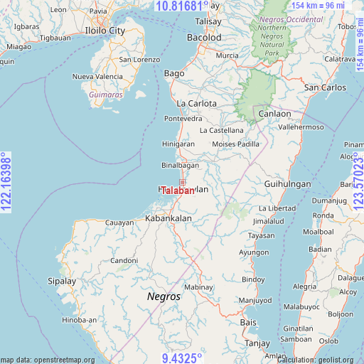
| Upper-left | 10.81681°, | 122.16398° |
| Center: | 10.1254°, | 122.8671° |
| Lower-right: | 9.4325°, | 123.57023° |
| Map W x H: | 153.9×153.9 km | = 95.6×95.6mi |
| max Lat: | 20.78733° ⇑67.1% North |
| Talaban: | 10.1254° |
| min Lat: | ⇓32.9% South 4.65442° |
| min Long | Talaban | max Long |
| 117.04868° | 122.8671° | 126.58417° |
| W 51%⇐ | ⇒49% E |
Elevation
Elevation of Talaban is 11 m = 36 ft, and this is 76.9 m = 252 ft below average elevation for this country.
| Max E: |
2262 m = 7421 ft | 73.2% |
| Avg. | 87.9 m = 288 ft | |
| Talaban | 11 m = 36 ft | |
Min E: |
-2 m = -7 ft | 26.8% |
See also: Philippines elevation on elevation.city.
Geographical zone
Talaban is located in North Torrid zone (between Equator and Tropic of Cancer). Distance of Equator is 1125.8 km =699.5 mi to South.| Distance of | km | miles | from Talaban |
|---|---|---|---|
| North Pole | 8881.2 | 5518.5 | to North |
| Arctic Circle | 6275.3 | 3899.3 | to North |
| Tropic Cancer | 1480.1 | 919.7 | to North |
| Equator | 1125.8 | 699.5 | to South |


Nearby cities:
15 places around Talaban: (largest is in red/bold)
• Aguisan
3.9 km =2.4 mi,  351°
351°
• Bagroy
11.5 km =7.1 mi,  41°
41°
• Biao
12.2 km =7.6 mi,  98°
98°
• Binalbagan
7.8 km =4.8 mi, 352°
• Cabadiangan
8.6 km =5.3 mi,  74°
74°
• Cabanbanan
10.9 km =6.8 mi,  114°
114°
• Carabalan
9.2 km =5.7 mi, 110°
• Himamaylan
3 km =1.9 mi,  172°
172°
• Libacao
7.9 km =4.9 mi, 40°
• Mambagatan
2.9 km =1.8 mi,  127°
127°
• Montilla
10.8 km =6.7 mi, 36°
• Nato
2.7 km =1.7 mi, 347°
• Patique
12.9 km =8 mi,  15°
15°
• Payao
8.5 km =5.3 mi,  46°
46°
• Suay
8.5 km =5.3 mi,  198°
198°
Sources, notices
• [Note1] Compared only with cities in Philippines existing in our database
• [Src1] Map data: © OpenStreetMap contributors (CC-BY-SA)
• [Src2] Other city data from geonames.org with taken over terms of usage.
• [Src3] Geographical zone / Annual Mean Temperature by Robert A. Rohde @ Wikipedia
