Himamaylan geodata
Himamaylan (Western Visayas) is a seat of a third-order administrative division; located in Philippines in Asia/Manila (GMT+8) time zone. With population of 25,089 people, there are 320 cities with bigger population in this country. Compared to other cities in Philippines, 67.4% of cities are located further ↑North; 51% of cities are located further ←West and 89.7% of cities have higher elevation than Himamaylan. Note1
Administrative division(s):
- Level 1: Western Visayas
- Level 2: Province of Negros Occidental
- Level 3: City of Himamaylan


Himamaylan GPS coordinates[2]
10° 5' 56.004" North, 122° 52' 14.016" East
| Map corner | latitude | longitude |
|---|---|---|
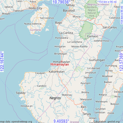
| Upper-left | 10.79036°, | 122.16744° |
| Center: | 10.09889°, | 122.87056° |
| Lower-right: | 9.40593°, | 123.57369° |
| Map W x H: | 153.9×153.9 km | = 95.6×95.6mi |
| max Lat: | 20.78733° ⇑67.4% North |
| Himamaylan: | 10.09889° |
| min Lat: | ⇓32.6% South 4.65442° |
| min Long | Himamaylan | max Long |
| 117.04868° | 122.87056° | 126.58417° |
| W 51%⇐ | ⇒49% E |
Elevation
Elevation of Himamaylan is 7 m = 23 ft, and this is 80.9 m = 265 ft below average elevation for this country.
| Max E: |
2262 m = 7421 ft | 89.7% |
| Avg. | 87.9 m = 288 ft | |
| Himamaylan | 7 m = 23 ft | |
Min E: |
-2 m = -7 ft | 10.3% |
See also: Philippines elevation on elevation.city.
Geographical zone
Himamaylan is located in North Torrid zone (between Equator and Tropic of Cancer). Distance of Equator is 1122.9 km =697.7 mi to South.| Distance of | km | miles | from Himamaylan |
|---|---|---|---|
| North Pole | 8884.2 | 5520.4 | to North |
| Arctic Circle | 6278.3 | 3901.2 | to North |
| Tropic Cancer | 1483 | 921.5 | to North |
| Equator | 1122.9 | 697.7 | to South |


Nearby cities:
15 places around Himamaylan: (largest is in red/bold)
• Aguisan
6.9 km =4.3 mi,  351°
351°
• Bagroy
13.6 km =8.5 mi,  31°
31°
• Biao
11.7 km =7.3 mi,  84°
84°
• Binalbagan
10.8 km =6.7 mi, 352°
• Cabadiangan
9.5 km =5.9 mi,  56°
56°
• Cabanbanan
9.7 km =6 mi,  99°
99°
• Carabalan
8.3 km =5.2 mi,  91°
91°
• Ilog
13.8 km =8.6 mi,  234°
234°
• Libacao
10.2 km =6.3 mi, 27°
• Mambagatan
2.3 km =1.4 mi, 59°
• Montilla
13 km =8.1 mi, 27°
• Nato
5.7 km =3.5 mi, 350°
• Payao
10.6 km =6.6 mi, 33°
• Suay
5.9 km =3.7 mi,  211°
211°
• Talaban
3 km =1.9 mi, 352°
Sources, notices
• [Note1] Compared only with cities in Philippines existing in our database
• [Src1] Map data: © OpenStreetMap contributors (CC-BY-SA)
• [Src2] Other city data from geonames.org with taken over terms of usage.
• [Src3] Geographical zone / Annual Mean Temperature by Robert A. Rohde @ Wikipedia
