Cabanbanan geodata
Cabanbanan (Western Visayas) is a populated place; located in Philippines in Asia/Manila (GMT+8) time zone. With population of 2,061 people, there are 4126 cities with bigger population in this country. Compared to other cities in Philippines, 67.5% of cities are located further ↑North; 52.5% of cities are located further ←West and 88.3% of cities have lower elevation than Cabanbanan. Note1
Administrative division(s):
- Level 1: Western Visayas
- Level 2: Province of Negros Occidental
- Level 3: City of Himamaylan


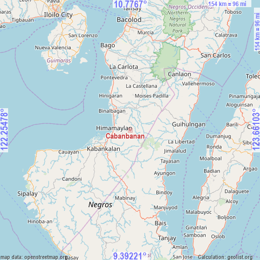
Cabanbanan GPS coordinates[2]
10° 5' 6.72" North, 122° 57' 28.44" East
| Map corner | latitude | longitude |
|---|---|---|
| Upper-left | 10.7767°, | 122.25478° |
| Center: | 10.0852°, | 122.9579° |
| Lower-right: | 9.39221°, | 123.66103° |
| Map W x H: | 153.9×153.9 km | = 95.6×95.6mi |
| max Lat: | 20.78733° ⇑67.5% North |
| Cabanbanan: | 10.0852° |
| min Lat: | ⇓32.5% South 4.65442° |
| min Long | Cabanbanan | max Long |
| 117.04868° | 122.9579° | 126.58417° |
| W 52.5%⇐ | ⇒47.5% E |
Elevation
Elevation of Cabanbanan is 186 m = 610 ft, and this is 98.1 m = 322 ft above average elevation for this country.
| Max E: |
2262 m = 7421 ft | 11.7% |
| Cabanbanan | 186 m 610 ft | |
| Avg. | 87.9 m = 288 ft | |
Min E: |
-2 m = -7 ft | 88.3% |
See also: Philippines elevation on elevation.city.
Geographical zone
Cabanbanan is located in North Torrid zone (between Equator and Tropic of Cancer). Distance of Equator is 1121.4 km =696.8 mi to South.| Distance of | km | miles | from Cabanbanan |
|---|---|---|---|
| North Pole | 8885.7 | 5521.3 | to North |
| Arctic Circle | 6279.8 | 3902.1 | to North |
| Tropic Cancer | 1484.5 | 922.4 | to North |
| Equator | 1121.4 | 696.8 | to South |


Nearby cities:
15 places around Cabanbanan: (largest is in red/bold)
• Aguisan
13.5 km =8.4 mi,  308°
308°
• Bagroy
13.3 km =8.3 mi,  349°
349°
• Biao
3.4 km =2.1 mi,  38°
38°
• Cabadiangan
6.9 km =4.3 mi, 346°
• Camangcamang
10.9 km =6.8 mi,  16°
16°
• Cansolungon
8.5 km =5.3 mi,  30°
30°
• Carabalan
1.8 km =1.1 mi, 313°
• Himamaylan
9.7 km =6 mi,  279°
279°
• Libacao
11.6 km =7.2 mi,  335°
335°
• Mambagatan
8.1 km =5 mi,  289°
289°
• Nato
12.7 km =7.9 mi,  304°
304°
• Payao
11 km =6.8 mi, 340°
• Santol
10.5 km =6.5 mi, 22°
• Suay
13.1 km =8.1 mi,  254°
254°
• Talaban
10.9 km =6.8 mi, 294°
Sources, notices
• [Note1] Compared only with cities in Philippines existing in our database
• [Src1] Map data: © OpenStreetMap contributors (CC-BY-SA)
• [Src2] Other city data from geonames.org with taken over terms of usage.
• [Src3] Geographical zone / Annual Mean Temperature by Robert A. Rohde @ Wikipedia
