Dumlan geodata
Dumlan (Davao) is a populated place; located in Philippines in Asia/Manila (GMT+8) time zone. With population of 2,661 people, there are 3016 cities with bigger population in this country. Compared to other cities in Philippines, 87.6% of cities are located further ↑North; 97% of cities are located further ←West and 71.2% of cities have lower elevation than Dumlan. Note1


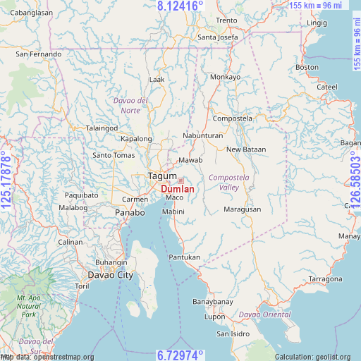
Dumlan GPS coordinates[2]
7° 25' 39" North, 125° 52' 54.84" East
| Map corner | latitude | longitude |
|---|---|---|
| Upper-left | 8.12416°, | 125.17878° |
| Center: | 7.4275°, | 125.8819° |
| Lower-right: | 6.72974°, | 126.58503° |
| Map W x H: | 155×155 km | = 96.3×96.3mi |
| max Lat: | 20.78733° ⇑87.6% North |
| Dumlan: | 7.4275° |
| min Lat: | ⇓12.4% South 4.65442° |
| min Long | Dumlan | max Long |
| 117.04868° | 125.8819° | 126.58417° |
| W 97%⇐ | ⇒3% E |
Elevation
Elevation of Dumlan is 55 m = 180 ft, and this is 32.9 m = 108 ft below average elevation for this country.
| Max E: |
2262 m = 7421 ft | 28.8% |
| Avg. | 87.9 m = 288 ft | |
| Dumlan | 55 m = 180 ft | |
Min E: |
-2 m = -7 ft | 71.2% |
See also: Philippines elevation on elevation.city.
Geographical zone
Dumlan is located in North Torrid zone (between Equator and Tropic of Cancer). Distance of Equator is 825.9 km =513.2 mi to South.| Distance of | km | miles | from Dumlan |
|---|---|---|---|
| North Pole | 9181.2 | 5704.9 | to North |
| Arctic Circle | 6575.3 | 4085.7 | to North |
| Tropic Cancer | 1780.1 | 1106.1 | to North |
| Equator | 825.9 | 513.2 | to South |


Nearby cities:
15 places around Dumlan: (largest is in red/bold)
• Andili
10.5 km =6.5 mi,  68°
68°
• Bincoñgan
16 km =9.9 mi,  245°
245°
• Corocotan
12.4 km =7.7 mi,  255°
255°
• Cuambog
13.7 km =8.5 mi,  195°
195°
• Del Pilar
16.3 km =10.1 mi,  338°
338°
• Hiju, Maco
7.5 km =4.7 mi,  231°
231°
• Libuganon
14.4 km =8.9 mi, 232°
• Mabini
13.3 km =8.3 mi,  193°
193°
• Maco
7.9 km =4.9 mi, 201°
• Magugpo Poblacion
8.8 km =5.5 mi,  284°
284°
• New Bohol
11.8 km =7.3 mi,  334°
334°
• New Sibonga
15.7 km =9.8 mi,  19°
19°
• Pagsabangan
15.8 km =9.8 mi,  292°
292°
• Pandasan
16.3 km =10.1 mi, 191°
• San Mariano
15.3 km =9.5 mi,  58°
58°
Sources, notices
• [Note1] Compared only with cities in Philippines existing in our database
• [Src1] Map data: © OpenStreetMap contributors (CC-BY-SA)
• [Src2] Other city data from geonames.org with taken over terms of usage.
• [Src3] Geographical zone / Annual Mean Temperature by Robert A. Rohde @ Wikipedia
