Taguisa geodata
Taguisa (Soccsksargen) is a populated place; located in Philippines in Asia/Manila (GMT+8) time zone. With population of 3,147 people, there are 2365 cities with bigger population in this country. Compared to other cities in Philippines, 94% of cities are located further ↑North; 71.9% of cities are located further ←West and 99.6% of cities have higher elevation than Taguisa. Note1
Administrative division(s):
- Level 1: Soccsksargen
- Level 2: Province of Sultan Kudarat
- Level 3: Lebak


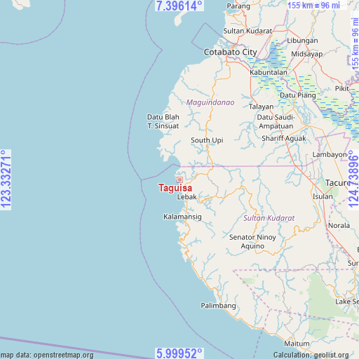
Taguisa GPS coordinates[2]
6° 41' 53.988" North, 124° 2' 8.988" East
| Map corner | latitude | longitude |
|---|---|---|
| Upper-left | 7.39614°, | 123.33271° |
| Center: | 6.69833°, | 124.03583° |
| Lower-right: | 5.99952°, | 124.73896° |
| Map W x H: | 155.3×155.3 km | = 96.5×96.5mi |
| max Lat: | 20.78733° ⇑94% North |
| Taguisa: | 6.69833° |
| min Lat: | ⇓6% South 4.65442° |
| min Long | Taguisa | max Long |
| 117.04868° | 124.03583° | 126.58417° |
| W 71.9%⇐ | ⇒28.1% E |
Elevation
Elevation of Taguisa is 1 m = 3 ft, and this is 86.9 m = 285 ft below average elevation for this country.
| Max E: |
2262 m = 7421 ft | 99.6% |
| Avg. | 87.9 m = 288 ft | |
| Taguisa | 1 m = 3 ft | |
Min E: |
-2 m = -7 ft | 0.4% |
See also: Philippines elevation on elevation.city.
Geographical zone
Taguisa is located in North Torrid zone (between Equator and Tropic of Cancer). Distance of Equator is 744.8 km =462.8 mi to South.| Distance of | km | miles | from Taguisa |
|---|---|---|---|
| North Pole | 9262.3 | 5755.3 | to North |
| Arctic Circle | 6656.4 | 4136.1 | to North |
| Tropic Cancer | 1861.1 | 1156.4 | to North |
| Equator | 744.8 | 462.8 | to South |


Nearby cities:
15 places around Taguisa: (largest is in red/bold)
• Bantogon
18.3 km =11.4 mi,  180°
180°
• Basak
13.1 km =8.1 mi,  75°
75°
• Gadung
11.7 km =7.3 mi,  351°
351°
• Kalamangog
4.7 km =2.9 mi,  50°
50°
• Kalamansig
16.4 km =10.2 mi,  174°
174°
• Kulaman
27.1 km =16.8 mi, 167°
• Lebak
6.9 km =4.3 mi,  151°
151°
• Limulan
12.9 km =8 mi, 167°
• Noling
8.3 km =5.2 mi,  121°
121°
• Puloypuloy
9.7 km =6 mi,  136°
136°
• Puricay
4 km =2.5 mi,  109°
109°
• Ragandang
10.1 km =6.3 mi, 112°
• Sangay
28.2 km =17.5 mi, 178°
• South Upi
19.6 km =12.2 mi,  40°
40°
• Tran
3.2 km =2 mi, 40°
Sources, notices
• [Note1] Compared only with cities in Philippines existing in our database
• [Src1] Map data: © OpenStreetMap contributors (CC-BY-SA)
• [Src2] Other city data from geonames.org with taken over terms of usage.
• [Src3] Geographical zone / Annual Mean Temperature by Robert A. Rohde @ Wikipedia
