Kalamangog geodata
Kalamangog (Soccsksargen) is a populated place; located in Philippines in Asia/Manila (GMT+8) time zone. With population of 2,956 people, there are 2581 cities with bigger population in this country. Compared to other cities in Philippines, 93.6% of cities are located further ↑North; 72.5% of cities are located further ←West and 92.7% of cities have higher elevation than Kalamangog. Note1
Administrative division(s):
- Level 1: Soccsksargen
- Level 2: Province of Sultan Kudarat
- Level 3: Lebak


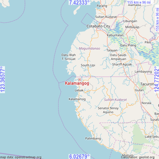
Kalamangog GPS coordinates[2]
6° 43' 32.016" North, 124° 4' 8.004" East
| Map corner | latitude | longitude |
|---|---|---|
| Upper-left | 7.42333°, | 123.36577° |
| Center: | 6.72556°, | 124.06889° |
| Lower-right: | 6.02679°, | 124.77202° |
| Map W x H: | 155.3×155.3 km | = 96.5×96.5mi |
| max Lat: | 20.78733° ⇑93.6% North |
| Kalamangog: | 6.72556° |
| min Lat: | ⇓6.4% South 4.65442° |
| min Long | Kalamangog | max Long |
| 117.04868° | 124.06889° | 126.58417° |
| W 72.5%⇐ | ⇒27.5% E |
Elevation
Elevation of Kalamangog is 6 m = 20 ft, and this is 81.9 m = 269 ft below average elevation for this country.
| Max E: |
2262 m = 7421 ft | 92.7% |
| Avg. | 87.9 m = 288 ft | |
| Kalamangog | 6 m = 20 ft | |
Min E: |
-2 m = -7 ft | 7.3% |
See also: Philippines elevation on elevation.city.
Geographical zone
Kalamangog is located in North Torrid zone (between Equator and Tropic of Cancer). Distance of Equator is 747.8 km =464.7 mi to South.| Distance of | km | miles | from Kalamangog |
|---|---|---|---|
| North Pole | 9259.2 | 5753.4 | to North |
| Arctic Circle | 6653.4 | 4134.2 | to North |
| Tropic Cancer | 1858.1 | 1154.6 | to North |
| Equator | 747.8 | 464.7 | to South |


Nearby cities:
15 places around Kalamangog: (largest is in red/bold)
• Bantogon
21.7 km =13.5 mi,  190°
190°
• Basak
9.1 km =5.7 mi,  88°
88°
• Gadung
10.1 km =6.3 mi,  327°
327°
• Kalamansig
19.4 km =12.1 mi, 185°
• Kulaman
29.6 km =18.4 mi,  175°
175°
• Lebak
9.1 km =5.7 mi, 182°
• Limulan
15.6 km =9.7 mi, 182°
• Noling
8.1 km =5 mi,  154°
154°
• Puloypuloy
10.5 km =6.5 mi,  163°
163°
• Puricay
4.4 km =2.7 mi, 179°
• Ragandang
8.9 km =5.5 mi,  140°
140°
• South Upi
15 km =9.3 mi,  36°
36°
• Taguisa
4.7 km =2.9 mi,  230°
230°
• Tapikan
31.3 km =19.4 mi,  63°
63°
• Tran
1.6 km =1 mi,  249°
249°
Sources, notices
• [Note1] Compared only with cities in Philippines existing in our database
• [Src1] Map data: © OpenStreetMap contributors (CC-BY-SA)
• [Src2] Other city data from geonames.org with taken over terms of usage.
• [Src3] Geographical zone / Annual Mean Temperature by Robert A. Rohde @ Wikipedia
