Puloypuloy geodata
Puloypuloy (Soccsksargen) is a populated place; located in Philippines in Asia/Manila (GMT+8) time zone. With population of 5,130 people, there are 1250 cities with bigger population in this country. Compared to other cities in Philippines, 94.7% of cities are located further ↑North; 72.7% of cities are located further ←West and 51.1% of cities have lower elevation than Puloypuloy. Note1
Administrative division(s):
- Level 1: Soccsksargen
- Level 2: Province of Sultan Kudarat
- Level 3: Lebak


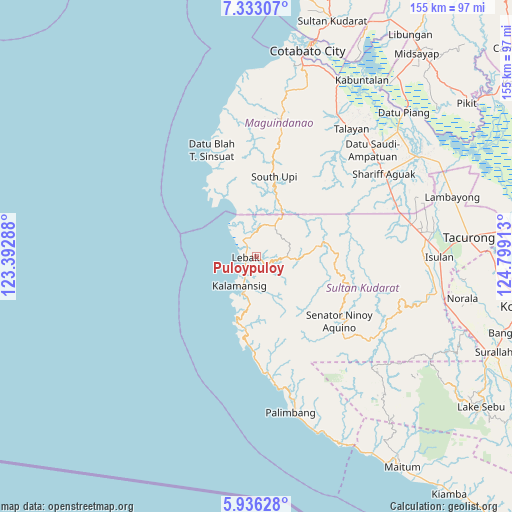
Puloypuloy GPS coordinates[2]
6° 38' 6.612" North, 124° 5' 45.6" East
| Map corner | latitude | longitude |
|---|---|---|
| Upper-left | 7.33307°, | 123.39288° |
| Center: | 6.63517°, | 124.096° |
| Lower-right: | 5.93628°, | 124.79913° |
| Map W x H: | 155.3×155.3 km | = 96.5×96.5mi |
| max Lat: | 20.78733° ⇑94.7% North |
| Puloypuloy: | 6.63517° |
| min Lat: | ⇓5.3% South 4.65442° |
| min Long | Puloypuloy | max Long |
| 117.04868° | 124.096° | 126.58417° |
| W 72.7%⇐ | ⇒27.3% E |
Elevation
Elevation of Puloypuloy is 24 m = 79 ft, and this is 63.9 m = 210 ft below average elevation for this country.
| Max E: |
2262 m = 7421 ft | 48.9% |
| Avg. | 87.9 m = 288 ft | |
| Puloypuloy | 24 m = 79 ft | |
Min E: |
-2 m = -7 ft | 51.1% |
See also: Philippines elevation on elevation.city.
Geographical zone
Puloypuloy is located in North Torrid zone (between Equator and Tropic of Cancer). Distance of Equator is 737.8 km =458.4 mi to South.| Distance of | km | miles | from Puloypuloy |
|---|---|---|---|
| North Pole | 9269.3 | 5759.7 | to North |
| Arctic Circle | 6663.4 | 4140.4 | to North |
| Tropic Cancer | 1868.2 | 1160.8 | to North |
| Equator | 737.8 | 458.4 | to South |


Nearby cities:
15 places around Puloypuloy: (largest is in red/bold)
• Bantogon
13.3 km =8.3 mi,  211°
211°
• Basak
11.9 km =7.4 mi,  30°
30°
• Gadung
20.4 km =12.7 mi,  335°
335°
• Kalamangog
10.5 km =6.5 mi, 343°
• Kalamansig
10.5 km =6.5 mi, 208°
• Kulaman
19.5 km =12.1 mi,  182°
182°
• Lebak
3.5 km =2.2 mi,  286°
286°
• Limulan
6.7 km =4.2 mi, 214°
• Noling
2.8 km =1.7 mi,  8°
8°
• Puricay
6.4 km =4 mi,  332°
332°
• Ragandang
4.2 km =2.6 mi,  40°
40°
• Sangay
21.9 km =13.6 mi,  195°
195°
• South Upi
22.8 km =14.2 mi,  15°
15°
• Taguisa
9.7 km =6 mi,  316°
316°
• Tran
10.5 km =6.5 mi, 334°
Sources, notices
• [Note1] Compared only with cities in Philippines existing in our database
• [Src1] Map data: © OpenStreetMap contributors (CC-BY-SA)
• [Src2] Other city data from geonames.org with taken over terms of usage.
• [Src3] Geographical zone / Annual Mean Temperature by Robert A. Rohde @ Wikipedia
