Tagoloan geodata
Tagoloan (Northern Mindanao) is a seat of a third-order administrative division; located in Philippines in Asia/Manila (GMT+8) time zone. With population of 30,390 people, there are 273 cities with bigger population in this country. Compared to other cities in Philippines, 78.2% of cities are located further ↑North; 83.3% of cities are located further ←West and 62.8% of cities have higher elevation than Tagoloan. Note1
Administrative division(s):
- Level 1: Northern Mindanao
- Level 2: Province of Misamis Oriental
- Level 3: Tagoloan


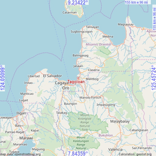
Tagoloan GPS coordinates[2]
8° 32' 22.344" North, 124° 45' 14.796" East
| Map corner | latitude | longitude |
|---|---|---|
| Upper-left | 9.23422°, | 124.05099° |
| Center: | 8.53954°, | 124.75411° |
| Lower-right: | 7.84359°, | 125.45724° |
| Map W x H: | 154.6×154.6 km | = 96.1×96.1mi |
| max Lat: | 20.78733° ⇑78.2% North |
| Tagoloan: | 8.53954° |
| min Lat: | ⇓21.8% South 4.65442° |
| min Long | Tagoloan | max Long |
| 117.04868° | 124.75411° | 126.58417° |
| W 83.3%⇐ | ⇒16.7% E |
Elevation
Elevation of Tagoloan is 15 m = 49 ft, and this is 72.9 m = 239 ft below average elevation for this country.
| Max E: |
2262 m = 7421 ft | 62.8% |
| Avg. | 87.9 m = 288 ft | |
| Tagoloan | 15 m = 49 ft | |
Min E: |
-2 m = -7 ft | 37.2% |
See also: Philippines elevation on elevation.city.
Geographical zone
Tagoloan is located in North Torrid zone (between Equator and Tropic of Cancer). Distance of Equator is 949.5 km =590 mi to South.| Distance of | km | miles | from Tagoloan |
|---|---|---|---|
| North Pole | 9057.6 | 5628.1 | to North |
| Arctic Circle | 6451.7 | 4008.9 | to North |
| Tropic Cancer | 1656.4 | 1029.2 | to North |
| Equator | 949.5 | 590 | to South |


Nearby cities:
15 places around Tagoloan: (largest is in red/bold)
• Agusan
5.8 km =3.6 mi,  198°
198°
• Alae
14.3 km =8.9 mi,  153°
153°
• Ani-e
15.2 km =9.4 mi,  57°
57°
• Aplaya
7.8 km =4.8 mi,  11°
11°
• Bugo
3.5 km =2.2 mi,  170°
170°
• Cagayan de Oro
13.4 km =8.3 mi,  241°
241°
• Jasaan
12.7 km =7.9 mi,  0°
0°
• Kimaya
9.8 km =6.1 mi,  73°
73°
• Malitbog
14.2 km =8.8 mi,  92°
92°
• Mambatangan
14.7 km =9.1 mi,  143°
143°
• Patrocinio
12.9 km =8 mi,  51°
51°
• San Martin
3.1 km =1.9 mi,  38°
38°
• Santa Ana
4.1 km =2.5 mi,  128°
128°
• Solana
9.5 km =5.9 mi, 11°
• Villanueva
6 km =3.7 mi,  23°
23°
Sources, notices
• [Note1] Compared only with cities in Philippines existing in our database
• [Src1] Map data: © OpenStreetMap contributors (CC-BY-SA)
• [Src2] Other city data from geonames.org with taken over terms of usage.
• [Src3] Geographical zone / Annual Mean Temperature by Robert A. Rohde @ Wikipedia
