Mambatangan geodata
Mambatangan (Northern Mindanao) is a populated place; located in Philippines in Asia/Manila (GMT+8) time zone. With population of 2,922 people, there are 2620 cities with bigger population in this country. Compared to other cities in Philippines, 79.2% of cities are located further ↑North; 85.1% of cities are located further ←West and 94.2% of cities have lower elevation than Mambatangan. Note1
Administrative division(s):
- Level 1: Northern Mindanao
- Level 2: Province of Bukidnon
- Level 3: Manolo Fortich


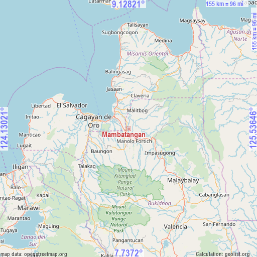
Mambatangan GPS coordinates[2]
8° 25' 59.988" North, 124° 49' 59.988" East
| Map corner | latitude | longitude |
|---|---|---|
| Upper-left | 9.12821°, | 124.13021° |
| Center: | 8.43333°, | 124.83333° |
| Lower-right: | 7.7372°, | 125.53646° |
| Map W x H: | 154.7×154.7 km | = 96.1×96.1mi |
| max Lat: | 20.78733° ⇑79.2% North |
| Mambatangan: | 8.43333° |
| min Lat: | ⇓20.8% South 4.65442° |
| min Long | Mambatangan | max Long |
| 117.04868° | 124.83333° | 126.58417° |
| W 85.1%⇐ | ⇒14.9% E |
Elevation
Elevation of Mambatangan is 382 m = 1253 ft, and this is 294.1 m = 965 ft above average elevation for this country.
| Max E: |
2262 m = 7421 ft | 5.8% |
| Mambatangan | 382 m 1253 ft | |
| Avg. | 87.9 m = 288 ft | |
Min E: |
-2 m = -7 ft | 94.2% |
See also: Philippines elevation on elevation.city.
Geographical zone
Mambatangan is located in North Torrid zone (between Equator and Tropic of Cancer). Distance of Equator is 937.7 km =582.7 mi to South.| Distance of | km | miles | from Mambatangan |
|---|---|---|---|
| North Pole | 9069.4 | 5635.5 | to North |
| Arctic Circle | 6463.5 | 4016.2 | to North |
| Tropic Cancer | 1668.2 | 1036.6 | to North |
| Equator | 937.7 | 582.7 | to South |


Nearby cities:
15 places around Mambatangan: (largest is in red/bold)
• Agusan
12.3 km =7.6 mi,  301°
301°
• Alae
2.5 km =1.6 mi,  246°
246°
• Bugo
11.6 km =7.2 mi,  315°
315°
• Dalirig
9.7 km =6 mi,  129°
129°
• Damilag
9 km =5.6 mi,  194°
194°
• Kimaya
14.6 km =9.1 mi,  2°
2°
• Libona
15.1 km =9.4 mi,  225°
225°
• Malitbog
12.4 km =7.7 mi,  26°
26°
• Maluko
14.8 km =9.2 mi,  116°
116°
• Manolo Fortich
7.9 km =4.9 mi,  154°
154°
• San Martin
15.8 km =9.8 mi,  334°
334°
• Sankanan
13.4 km =8.3 mi,  168°
168°
• Santa Ana
10.8 km =6.7 mi, 329°
• Santa Fe
11.6 km =7.2 mi,  209°
209°
• Tagoloan
14.7 km =9.1 mi, 323°
Sources, notices
• [Note1] Compared only with cities in Philippines existing in our database
• [Src1] Map data: © OpenStreetMap contributors (CC-BY-SA)
• [Src2] Other city data from geonames.org with taken over terms of usage.
• [Src3] Geographical zone / Annual Mean Temperature by Robert A. Rohde @ Wikipedia
