Suba geodata
Suba (Mimaropa) is a populated place; located in Philippines in Asia/Manila (GMT+8) time zone. With population of 2,966 people, there are 2570 cities with bigger population in this country. Compared to other cities in Philippines, 59.1% of cities are located further ↑North; 76.2% of cities are located further →East and 97.1% of cities have higher elevation than Suba. Note1


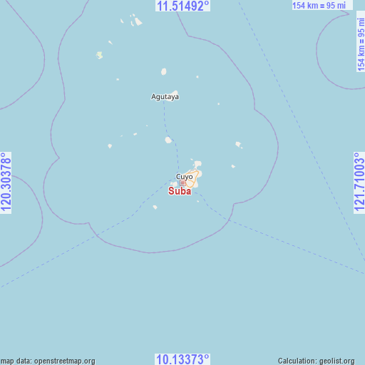
Suba GPS coordinates[2]
10° 49' 30.432" North, 121° 0' 24.84" East
| Map corner | latitude | longitude |
|---|---|---|
| Upper-left | 11.51492°, | 120.30378° |
| Center: | 10.82512°, | 121.0069° |
| Lower-right: | 10.13373°, | 121.71003° |
| Map W x H: | 153.6×153.6 km | = 95.4×95.4mi |
| max Lat: | 20.78733° ⇑59.1% North |
| Suba: | 10.82512° |
| min Lat: | ⇓40.9% South 4.65442° |
| min Long | Suba | max Long |
| 117.04868° | 121.0069° | 126.58417° |
| W 23.8%⇐ | ⇒76.2% E |
Elevation
Elevation of Suba is 4 m = 13 ft, and this is 83.9 m = 275 ft below average elevation for this country.
| Max E: |
2262 m = 7421 ft | 97.1% |
| Avg. | 87.9 m = 288 ft | |
| Suba | 4 m = 13 ft | |
Min E: |
-2 m = -7 ft | 2.9% |
See also: Philippines elevation on elevation.city.
Geographical zone
Suba is located in North Torrid zone (between Equator and Tropic of Cancer). Distance of Equator is 1203.6 km =747.9 mi to South.| Distance of | km | miles | from Suba |
|---|---|---|---|
| North Pole | 8803.4 | 5470.2 | to North |
| Arctic Circle | 6197.5 | 3850.9 | to North |
| Tropic Cancer | 1402.3 | 871.3 | to North |
| Equator | 1203.6 | 747.9 | to South |


Nearby cities:
15 places around Suba: (largest is in red/bold)
• Agutaya
36.6 km =22.7 mi,  348°
348°
• Algeciras
68.8 km =42.8 mi,  342°
342°
• Anini-y
109.7 km =68.2 mi,  113°
113°
• Aurelliana
106.1 km =65.9 mi,  86°
86°
• Belison
104.2 km =64.7 mi, 89°
• Catungan
110.3 km =68.5 mi, 93°
• Cuyo
3.1 km =1.9 mi,  3°
3°
• Egaña
109.9 km =68.3 mi, 94°
• Hamtic
107.4 km =66.7 mi,  97°
97°
• Magsaysay
7.4 km =4.6 mi,  42°
42°
• Patnongon
108.2 km =67.2 mi,  84°
84°
• Piape I
106 km =65.9 mi, 95°
• San Jose
102.5 km =63.7 mi, 94°
• San Pedro
103 km =64 mi, 91°
• Tobias Fornier
108.3 km =67.3 mi, 108°
Sources, notices
• [Note1] Compared only with cities in Philippines existing in our database
• [Src1] Map data: © OpenStreetMap contributors (CC-BY-SA)
• [Src2] Other city data from geonames.org with taken over terms of usage.
• [Src3] Geographical zone / Annual Mean Temperature by Robert A. Rohde @ Wikipedia
