Agutaya geodata
Agutaya (Mimaropa) is a populated place; located in Philippines in Asia/Manila (GMT+8) time zone. With population of 4,989 people, there are 1302 cities with bigger population in this country. Compared to other cities in Philippines, 55.1% of cities are located further ↑North; 77.9% of cities are located further →East and 50.3% of cities have higher elevation than Agutaya. Note1


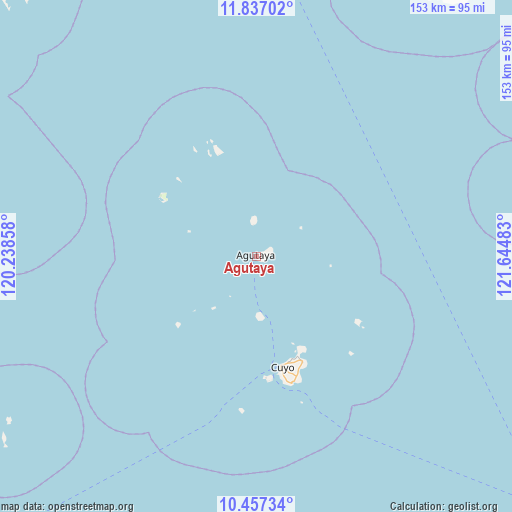
Agutaya GPS coordinates[2]
11° 8' 52.8" North, 120° 56' 30.12" East
| Map corner | latitude | longitude |
|---|---|---|
| Upper-left | 11.83702°, | 120.23858° |
| Center: | 11.148°, | 120.9417° |
| Lower-right: | 10.45734°, | 121.64483° |
| Map W x H: | 153.4×153.4 km | = 95.3×95.3mi |
| max Lat: | 20.78733° ⇑55.1% North |
| Agutaya: | 11.148° |
| min Lat: | ⇓44.9% South 4.65442° |
| min Long | Agutaya | max Long |
| 117.04868° | 120.9417° | 126.58417° |
| W 22.1%⇐ | ⇒77.9% E |
Elevation
Elevation of Agutaya is 23 m = 75 ft, and this is 64.9 m = 213 ft below average elevation for this country.
| Max E: |
2262 m = 7421 ft | 50.3% |
| Avg. | 87.9 m = 288 ft | |
| Agutaya | 23 m = 75 ft | |
Min E: |
-2 m = -7 ft | 49.7% |
See also: Philippines elevation on elevation.city.
Geographical zone
Agutaya is located in North Torrid zone (between Equator and Tropic of Cancer). Distance of Equator is 1239.5 km =770.2 mi to South.| Distance of | km | miles | from Agutaya |
|---|---|---|---|
| North Pole | 8767.5 | 5447.9 | to North |
| Arctic Circle | 6161.6 | 3828.6 | to North |
| Tropic Cancer | 1366.4 | 849 | to North |
| Equator | 1239.5 | 770.2 | to South |


Nearby cities:
15 places around Agutaya: (largest is in red/bold)
• Algeciras
32.7 km =20.3 mi,  335°
335°
• Aurelliana
116.7 km =72.5 mi,  104°
104°
• Belison
116.4 km =72.3 mi,  107°
107°
• Bulalacao
106.9 km =66.4 mi,  308°
308°
• Caluya
109.3 km =67.9 mi,  37°
37°
• Cuyo
33.7 km =20.9 mi,  167°
167°
• Jarigue
96.5 km =60 mi,  34°
34°
• Lawa-an
119.1 km =74 mi,  89°
89°
• Magsaysay
32.8 km =20.4 mi,  158°
158°
• Patnongon
117.7 km =73.1 mi, 102°
• San Jose
118 km =73.3 mi, 112°
• San Pedro
116.6 km =72.5 mi, 109°
• Semirara
113.9 km =70.8 mi, 25°
• Suba
36.6 km =22.7 mi, 168°
• Tinogboc
108.4 km =67.4 mi, 28°
Sources, notices
• [Note1] Compared only with cities in Philippines existing in our database
• [Src1] Map data: © OpenStreetMap contributors (CC-BY-SA)
• [Src2] Other city data from geonames.org with taken over terms of usage.
• [Src3] Geographical zone / Annual Mean Temperature by Robert A. Rohde @ Wikipedia
