Cuyo geodata
Cuyo (Mimaropa) is a seat of a third-order administrative division; located in Philippines in Asia/Manila (GMT+8) time zone. With population of 7,549 people, there are 821 cities with bigger population in this country. Compared to other cities in Philippines, 58.7% of cities are located further ↑North; 76.1% of cities are located further →East and 95.5% of cities have higher elevation than Cuyo. Note1


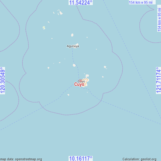
Cuyo GPS coordinates[2]
10° 51' 9" North, 121° 0' 30.996" East
| Map corner | latitude | longitude |
|---|---|---|
| Upper-left | 11.54224°, | 120.30549° |
| Center: | 10.8525°, | 121.00861° |
| Lower-right: | 10.16117°, | 121.71174° |
| Map W x H: | 153.6×153.6 km | = 95.4×95.4mi |
| max Lat: | 20.78733° ⇑58.7% North |
| Cuyo: | 10.8525° |
| min Lat: | ⇓41.3% South 4.65442° |
| min Long | Cuyo | max Long |
| 117.04868° | 121.00861° | 126.58417° |
| W 23.9%⇐ | ⇒76.1% E |
Elevation
Elevation of Cuyo is 5 m = 16 ft, and this is 82.9 m = 272 ft below average elevation for this country.
| Max E: |
2262 m = 7421 ft | 95.5% |
| Avg. | 87.9 m = 288 ft | |
| Cuyo | 5 m = 16 ft | |
Min E: |
-2 m = -7 ft | 4.5% |
See also: Philippines elevation on elevation.city.
Geographical zone
Cuyo is located in North Torrid zone (between Equator and Tropic of Cancer). Distance of Equator is 1206.7 km =749.8 mi to South.| Distance of | km | miles | from Cuyo |
|---|---|---|---|
| North Pole | 8800.4 | 5468.3 | to North |
| Arctic Circle | 6194.5 | 3849.1 | to North |
| Tropic Cancer | 1399.2 | 869.4 | to North |
| Equator | 1206.7 | 749.8 | to South |


Nearby cities:
15 places around Cuyo: (largest is in red/bold)
• Agutaya
33.7 km =20.9 mi,  347°
347°
• Algeciras
66 km =41 mi,  341°
341°
• Aurelliana
105.8 km =65.7 mi,  88°
88°
• Belison
104 km =64.6 mi, 90°
• Catungan
110.3 km =68.5 mi, 94°
• Egaña
110 km =68.4 mi,  96°
96°
• Hamtic
107.7 km =66.9 mi, 98°
• Magsaysay
5.4 km =3.4 mi,  63°
63°
• Patnongon
107.8 km =67 mi, 86°
• Piape I
106.2 km =66 mi, 97°
• San Jose
102.6 km =63.8 mi, 96°
• San Pedro
103 km =64 mi, 93°
• Sibalom
110.4 km =68.6 mi, 93°
• Suba
3.1 km =1.9 mi,  183°
183°
• Tobias Fornier
109.1 km =67.8 mi,  110°
110°
Sources, notices
• [Note1] Compared only with cities in Philippines existing in our database
• [Src1] Map data: © OpenStreetMap contributors (CC-BY-SA)
• [Src2] Other city data from geonames.org with taken over terms of usage.
• [Src3] Geographical zone / Annual Mean Temperature by Robert A. Rohde @ Wikipedia
