Algeciras geodata
Algeciras (Mimaropa) is a populated place; located in Philippines in Asia/Manila (GMT+8) time zone. With population of 4,007 people, there are 1724 cities with bigger population in this country. Compared to other cities in Philippines, 52.4% of cities are located further ↑North; 81.8% of cities are located further →East and 60.8% of cities have higher elevation than Algeciras. Note1


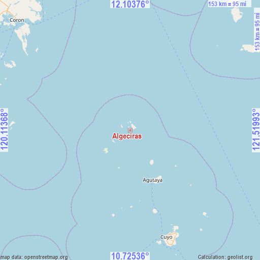
Algeciras GPS coordinates[2]
11° 24' 55.44" North, 120° 49' 0.48" East
| Map corner | latitude | longitude |
|---|---|---|
| Upper-left | 12.10376°, | 120.11368° |
| Center: | 11.4154°, | 120.8168° |
| Lower-right: | 10.72536°, | 121.51993° |
| Map W x H: | 153.3×153.3 km | = 95.3×95.3mi |
| max Lat: | 20.78733° ⇑52.4% North |
| Algeciras: | 11.4154° |
| min Lat: | ⇓47.6% South 4.65442° |
| min Long | Algeciras | max Long |
| 117.04868° | 120.8168° | 126.58417° |
| W 18.2%⇐ | ⇒81.8% E |
Elevation
Elevation of Algeciras is 16 m = 52 ft, and this is 71.9 m = 236 ft below average elevation for this country.
| Max E: |
2262 m = 7421 ft | 60.8% |
| Avg. | 87.9 m = 288 ft | |
| Algeciras | 16 m = 52 ft | |
Min E: |
-2 m = -7 ft | 39.2% |
See also: Philippines elevation on elevation.city.
Geographical zone
Algeciras is located in North Torrid zone (between Equator and Tropic of Cancer). Distance of Equator is 1269.3 km =788.7 mi to South.| Distance of | km | miles | from Algeciras |
|---|---|---|---|
| North Pole | 8737.8 | 5429.4 | to North |
| Arctic Circle | 6131.9 | 3810.2 | to North |
| Tropic Cancer | 1336.6 | 830.5 | to North |
| Equator | 1269.3 | 788.7 | to South |


Nearby cities:
15 places around Algeciras: (largest is in red/bold)
• Agutaya
32.7 km =20.3 mi,  155°
155°
• Alibug
100.9 km =62.7 mi,  26°
26°
• Bulalacao
79.2 km =49.2 mi,  297°
297°
• Caluya
98.1 km =61 mi,  54°
54°
• Caminauit
105.9 km =65.8 mi,  15°
15°
• Coron
93 km =57.8 mi,  314°
314°
• Cuyo
66 km =41 mi, 161°
• Jarigue
84.4 km =52.4 mi, 53°
• Magsaysay
65.5 km =40.7 mi, 156°
• San Jose
107.7 km =66.9 mi,  14°
14°
• San Miguel
103.5 km =64.3 mi,  274°
274°
• Santa Teresa
98.4 km =61.1 mi, 19°
• Semirara
96.5 km =60 mi,  41°
41°
• Suba
68.8 km =42.8 mi, 162°
• Tinogboc
92.4 km =57.4 mi, 44°
Sources, notices
• [Note1] Compared only with cities in Philippines existing in our database
• [Src1] Map data: © OpenStreetMap contributors (CC-BY-SA)
• [Src2] Other city data from geonames.org with taken over terms of usage.
• [Src3] Geographical zone / Annual Mean Temperature by Robert A. Rohde @ Wikipedia
