Simanu Sur geodata
Simanu Sur (Cagayan Valley) is a populated place; located in Philippines in Asia/Manila (GMT+8) time zone. With population of 2,617 people, there are 3079 cities with bigger population in this country. Compared to other cities in Philippines, 96.1% of cities are located further ↓South; 62.3% of cities are located further →East and 67.5% of cities have lower elevation than Simanu Sur. Note1


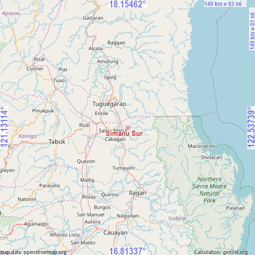
Simanu Sur GPS coordinates[2]
17° 29' 6.828" North, 121° 50' 3.336" East
| Map corner | latitude | longitude |
|---|---|---|
| Upper-left | 18.15462°, | 121.13114° |
| Center: | 17.48523°, | 121.83426° |
| Lower-right: | 16.81337°, | 122.53739° |
| Map W x H: | 149.1×149.1 km | = 92.6×92.6mi |
| max Lat: | 20.78733° ⇑3.9% North |
| Simanu Sur: | 17.48523° |
| min Lat: | ⇓96.1% South 4.65442° |
| min Long | Simanu Sur | max Long |
| 117.04868° | 121.83426° | 126.58417° |
| W 37.7%⇐ | ⇒62.3% E |
Elevation
Elevation of Simanu Sur is 47 m = 154 ft, and this is 40.9 m = 134 ft below average elevation for this country.
| Max E: |
2262 m = 7421 ft | 32.5% |
| Avg. | 87.9 m = 288 ft | |
| Simanu Sur | 47 m = 154 ft | |
Min E: |
-2 m = -7 ft | 67.5% |
See also: Philippines elevation on elevation.city.
Geographical zone
Simanu Sur is located in North Torrid zone (between Equator and Tropic of Cancer). Distance of this Northern Tropic circle is 661.7 km =411.2 mi to North.| Distance of | km | miles | from Simanu Sur |
|---|---|---|---|
| North Pole | 8062.9 | 5010.1 | to North |
| Arctic Circle | 5457 | 3390.8 | to North |
| Tropic Cancer | 661.7 | 411.2 | to North |
| Equator | 1944.2 | 1208.1 | to South |


Nearby cities:
15 places around Simanu Sur: (largest is in red/bold)
• Bangad
6.2 km =3.9 mi,  280°
280°
• Binguang
5.1 km =3.2 mi,  234°
234°
• Cabagan
9.4 km =5.8 mi, 227°
• Calamagui East
7 km =4.3 mi,  272°
272°
• Divisoria
7.6 km =4.7 mi,  303°
303°
• Enrile
16.7 km =10.4 mi, 299°
• Magalalag
14.7 km =9.1 mi,  314°
314°
• Masipi West
11.8 km =7.3 mi,  177°
177°
• Minanga Norte
6.3 km =3.9 mi, 234°
• Mozzozzin Sur
9.9 km =6.2 mi,  251°
251°
• Pilig
17.1 km =10.6 mi,  202°
202°
• San Bernardo
12.5 km =7.8 mi,  224°
224°
• San Juan
12.8 km =8 mi, 226°
• Santa Maria
8.9 km =5.5 mi,  256°
256°
• Santo Tomas
12 km =7.5 mi, 217°
Sources, notices
• [Note1] Compared only with cities in Philippines existing in our database
• [Src1] Map data: © OpenStreetMap contributors (CC-BY-SA)
• [Src2] Other city data from geonames.org with taken over terms of usage.
• [Src3] Geographical zone / Annual Mean Temperature by Robert A. Rohde @ Wikipedia
