San Nicolas geodata
San Nicolas (Western Visayas) is a populated place; located in Philippines in Asia/Manila (GMT+8) time zone. With population of 2,364 people, there are 3530 cities with bigger population in this country. Compared to other cities in Philippines, 53% of cities are located further ↑North; 54.4% of cities are located further →East and 70.5% of cities have lower elevation than San Nicolas. Note1


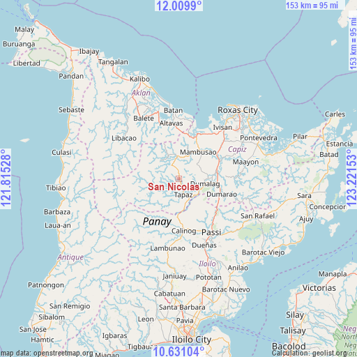
San Nicolas GPS coordinates[2]
11° 19' 16.68" North, 122° 31' 6.24" East
| Map corner | latitude | longitude |
|---|---|---|
| Upper-left | 12.0099°, | 121.81528° |
| Center: | 11.3213°, | 122.5184° |
| Lower-right: | 10.63104°, | 123.22153° |
| Map W x H: | 153.3×153.3 km | = 95.3×95.3mi |
| max Lat: | 20.78733° ⇑53% North |
| San Nicolas: | 11.3213° |
| min Lat: | ⇓47% South 4.65442° |
| min Long | San Nicolas | max Long |
| 117.04868° | 122.5184° | 126.58417° |
| W 45.6%⇐ | ⇒54.4% E |
Elevation
Elevation of San Nicolas is 53 m = 174 ft, and this is 34.9 m = 115 ft below average elevation for this country.
| Max E: |
2262 m = 7421 ft | 29.5% |
| Avg. | 87.9 m = 288 ft | |
| San Nicolas | 53 m = 174 ft | |
Min E: |
-2 m = -7 ft | 70.5% |
See also: Philippines elevation on elevation.city.
Geographical zone
San Nicolas is located in North Torrid zone (between Equator and Tropic of Cancer). Distance of Equator is 1258.8 km =782.2 mi to South.| Distance of | km | miles | from San Nicolas |
|---|---|---|---|
| North Pole | 8748.3 | 5435.9 | to North |
| Arctic Circle | 6142.4 | 3816.7 | to North |
| Tropic Cancer | 1347.1 | 837 | to North |
| Equator | 1258.8 | 782.2 | to South |


Nearby cities:
15 places around San Nicolas: (largest is in red/bold)
• Ag-ambulong
5.3 km =3.3 mi,  349°
349°
• Bingawan
11.2 km =7 mi,  151°
151°
• Bula
15.1 km =9.4 mi,  21°
21°
• Burias
14.3 km =8.9 mi,  13°
13°
• Candelaria
3.6 km =2.2 mi,  172°
172°
• Consolacion
12.5 km =7.8 mi,  86°
86°
• Da-an Sur
12.6 km =7.8 mi,  238°
238°
• Dumalag
11.6 km =7.2 mi,  97°
97°
• Duran
10.4 km =6.5 mi,  129°
129°
• Jamindan
9 km =5.6 mi, 346°
• Lucero
15.9 km =9.9 mi,  338°
338°
• Mambusao
15.2 km =9.4 mi,  34°
34°
• San Miguel
12.2 km =7.6 mi, 167°
• Santa Angel
13.4 km =8.3 mi, 96°
• Tapas
7 km =4.3 mi,  163°
163°
Sources, notices
• [Note1] Compared only with cities in Philippines existing in our database
• [Src1] Map data: © OpenStreetMap contributors (CC-BY-SA)
• [Src2] Other city data from geonames.org with taken over terms of usage.
• [Src3] Geographical zone / Annual Mean Temperature by Robert A. Rohde @ Wikipedia
