Candelaria geodata
Candelaria (Western Visayas) is a populated place; located in Philippines in Asia/Manila (GMT+8) time zone. With population of 2,178 people, there are 3928 cities with bigger population in this country. Compared to other cities in Philippines, 53.4% of cities are located further ↑North; 54.2% of cities are located further →East and 66.4% of cities have lower elevation than Candelaria. Note1


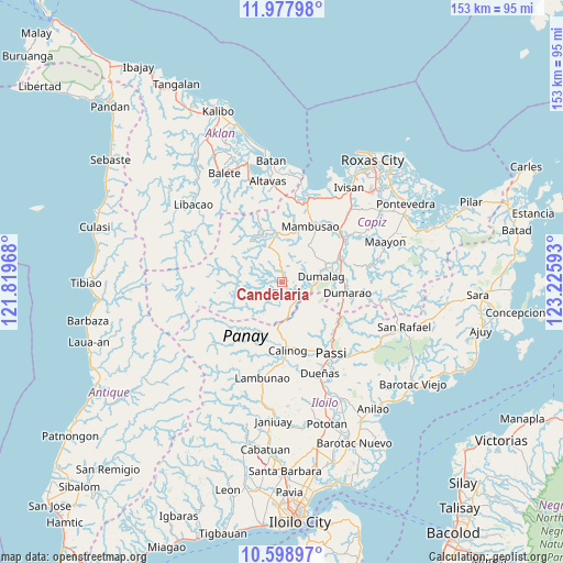
Candelaria GPS coordinates[2]
11° 17' 21.48" North, 122° 31' 22.08" East
| Map corner | latitude | longitude |
|---|---|---|
| Upper-left | 11.97798°, | 121.81968° |
| Center: | 11.2893°, | 122.5228° |
| Lower-right: | 10.59897°, | 123.22593° |
| Map W x H: | 153.3×153.3 km | = 95.3×95.3mi |
| max Lat: | 20.78733° ⇑53.4% North |
| Candelaria: | 11.2893° |
| min Lat: | ⇓46.6% South 4.65442° |
| min Long | Candelaria | max Long |
| 117.04868° | 122.5228° | 126.58417° |
| W 45.8%⇐ | ⇒54.2% E |
Elevation
Elevation of Candelaria is 44 m = 144 ft, and this is 43.9 m = 144 ft below average elevation for this country.
| Max E: |
2262 m = 7421 ft | 33.6% |
| Avg. | 87.9 m = 288 ft | |
| Candelaria | 44 m = 144 ft | |
Min E: |
-2 m = -7 ft | 66.4% |
See also: Philippines elevation on elevation.city.
Geographical zone
Candelaria is located in North Torrid zone (between Equator and Tropic of Cancer). Distance of Equator is 1255.3 km =780 mi to South.| Distance of | km | miles | from Candelaria |
|---|---|---|---|
| North Pole | 8751.8 | 5438.1 | to North |
| Arctic Circle | 6145.9 | 3818.9 | to North |
| Tropic Cancer | 1350.7 | 839.3 | to North |
| Equator | 1255.3 | 780 | to South |


Nearby cities:
15 places around Candelaria: (largest is in red/bold)
• Ag-ambulong
8.9 km =5.5 mi,  350°
350°
• Alibunan
17.3 km =10.7 mi,  203°
203°
• Badlan
16.4 km =10.2 mi,  181°
181°
• Bingawan
7.9 km =4.9 mi,  142°
142°
• Consolacion
12.8 km =8 mi,  70°
70°
• Cuartero
17 km =10.6 mi, 70°
• Da-an Sur
11.6 km =7.2 mi,  254°
254°
• Dumalag
11.2 km =7 mi,  79°
79°
• Duran
8.1 km =5 mi,  112°
112°
• Jamindan
12.6 km =7.8 mi, 347°
• Manjoy
17.2 km =10.7 mi, 65°
• San Miguel
8.6 km =5.3 mi,  165°
165°
• San Nicolas
3.6 km =2.2 mi, 352°
• Santa Angel
13 km =8.1 mi, 81°
• Tapas
3.4 km =2.1 mi,  154°
154°
Sources, notices
• [Note1] Compared only with cities in Philippines existing in our database
• [Src1] Map data: © OpenStreetMap contributors (CC-BY-SA)
• [Src2] Other city data from geonames.org with taken over terms of usage.
• [Src3] Geographical zone / Annual Mean Temperature by Robert A. Rohde @ Wikipedia
