Sanlibo geodata
Sanlibo (Ilocos) is a populated place; located in Philippines in Asia/Manila (GMT+8) time zone. With population of 2,609 people, there are 3094 cities with bigger population in this country. Compared to other cities in Philippines, 86.3% of cities are located further ↓South; 89.6% of cities are located further →East and 51.1% of cities have lower elevation than Sanlibo. Note1


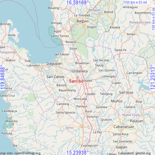
Sanlibo GPS coordinates[2]
15° 55' 0.012" North, 120° 33' 0" East
| Map corner | latitude | longitude |
|---|---|---|
| Upper-left | 16.59169°, | 119.84688° |
| Center: | 15.91667°, | 120.55° |
| Lower-right: | 15.23938°, | 121.25313° |
| Map W x H: | 150.4×150.4 km | = 93.5×93.5mi |
| max Lat: | 20.78733° ⇑13.7% North |
| Sanlibo: | 15.91667° |
| min Lat: | ⇓86.3% South 4.65442° |
| min Long | Sanlibo | max Long |
| 117.04868° | 120.55° | 126.58417° |
| W 10.4%⇐ | ⇒89.6% E |
Elevation
Elevation of Sanlibo is 24 m = 79 ft, and this is 63.9 m = 210 ft below average elevation for this country.
| Max E: |
2262 m = 7421 ft | 48.9% |
| Avg. | 87.9 m = 288 ft | |
| Sanlibo | 24 m = 79 ft | |
Min E: |
-2 m = -7 ft | 51.1% |
See also: Philippines elevation on elevation.city.
Geographical zone
Sanlibo is located in North Torrid zone (between Equator and Tropic of Cancer). Distance of this Northern Tropic circle is 836.2 km =519.6 mi to North.| Distance of | km | miles | from Sanlibo |
|---|---|---|---|
| North Pole | 8237.3 | 5118.4 | to North |
| Arctic Circle | 5631.4 | 3499.2 | to North |
| Tropic Cancer | 836.2 | 519.6 | to North |
| Equator | 1769.8 | 1099.7 | to South |


Nearby cities:
15 places around Sanlibo: (largest is in red/bold)
• Alcala
8.2 km =5.1 mi,  199°
199°
• Bacag
3.8 km =2.4 mi,  66°
66°
• Bacundao Weste
7.8 km =4.8 mi,  268°
268°
• Barangobong
4.3 km =2.7 mi,  182°
182°
• Canan Norte
7.8 km =4.8 mi,  264°
264°
• Capulaan
1.9 km =1.2 mi,  226°
226°
• Caramutan
6.4 km =4 mi,  85°
85°
• Carmen
6.3 km =3.9 mi,  122°
122°
• Lunec
7.7 km =4.8 mi,  302°
302°
• Pindangan Centro
6.2 km =3.9 mi, 178°
• Puelay
4.2 km =2.6 mi,  142°
142°
• Tombod
2.5 km =1.6 mi,  47°
47°
• Unzad
1.2 km =0.7 mi,  282°
282°
• Urdaneta
7 km =4.3 mi,  18°
18°
• Villasis
4.4 km =2.7 mi,  112°
112°
Sources, notices
• [Note1] Compared only with cities in Philippines existing in our database
• [Src1] Map data: © OpenStreetMap contributors (CC-BY-SA)
• [Src2] Other city data from geonames.org with taken over terms of usage.
• [Src3] Geographical zone / Annual Mean Temperature by Robert A. Rohde @ Wikipedia
