San Miguel geodata
San Miguel (Central Luzon) is a populated place; located in Philippines in Asia/Manila (GMT+8) time zone. With population of 65,661 people, there are 144 cities with bigger population in this country. Compared to other cities in Philippines, 78.7% of cities are located further ↓South; 76.9% of cities are located further →East and 51.1% of cities have lower elevation than San Miguel. Note1


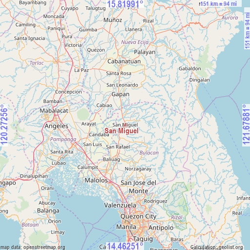
San Miguel GPS coordinates[2]
15° 8' 32.28" North, 120° 58' 32.448" East
| Map corner | latitude | longitude |
|---|---|---|
| Upper-left | 15.81991°, | 120.27256° |
| Center: | 15.1423°, | 120.97568° |
| Lower-right: | 14.46251°, | 121.67881° |
| Map W x H: | 150.9×150.9 km | = 93.8×93.8mi |
| max Lat: | 20.78733° ⇑21.3% North |
| San Miguel: | 15.1423° |
| min Lat: | ⇓78.7% South 4.65442° |
| min Long | San Miguel | max Long |
| 117.04868° | 120.97568° | 126.58417° |
| W 23.1%⇐ | ⇒76.9% E |
Elevation
Elevation of San Miguel is 24 m = 79 ft, and this is 63.9 m = 210 ft below average elevation for this country.
| Max E: |
2262 m = 7421 ft | 48.9% |
| Avg. | 87.9 m = 288 ft | |
| San Miguel | 24 m = 79 ft | |
Min E: |
-2 m = -7 ft | 51.1% |
See also: San Miguel elevation on elevation.city.
Geographical zone
San Miguel is located in North Torrid zone (between Equator and Tropic of Cancer). Distance of this Northern Tropic circle is 922.3 km =573.1 mi to North.| Distance of | km | miles | from San Miguel |
|---|---|---|---|
| North Pole | 8323.4 | 5171.9 | to North |
| Arctic Circle | 5717.5 | 3552.7 | to North |
| Tropic Cancer | 922.3 | 573.1 | to North |
| Equator | 1683.7 | 1046.2 | to South |


Nearby cities:
15 places around San Miguel: (largest is in red/bold)
• Batasan Bata
3.8 km =2.4 mi,  273°
273°
• Bulualto
9.1 km =5.7 mi,  344°
344°
• Calumpang
6.4 km =4 mi,  56°
56°
• Camias
2.7 km =1.7 mi,  356°
356°
• Mandili
11.3 km =7 mi,  291°
291°
• Mapaniqui
6.9 km =4.3 mi,  235°
235°
• Masalipit
6.6 km =4.1 mi,  84°
84°
• Pinambaran
6.7 km =4.2 mi,  2°
2°
• Pulo
12.6 km =7.8 mi, 336°
• Salapungan
5.2 km =3.2 mi,  259°
259°
• San Ildefonso
7.8 km =4.8 mi,  208°
208°
• Santa Lucia
8.2 km =5.1 mi,  23°
23°
• Sibul
9.7 km =6 mi,  72°
72°
• Tartaro
5.2 km =3.2 mi, 58°
• Vizal San Pablo
12 km =7.5 mi,  222°
222°
Sources, notices
• [Note1] Compared only with cities in Philippines existing in our database
• [Src1] Map data: © OpenStreetMap contributors (CC-BY-SA)
• [Src2] Other city data from geonames.org with taken over terms of usage.
• [Src3] Geographical zone / Annual Mean Temperature by Robert A. Rohde @ Wikipedia
