San Ignacio geodata
San Ignacio (Davao) is a populated place; located in Philippines in Asia/Manila (GMT+8) time zone. With population of 6,300 people, there are 993 cities with bigger population in this country. Compared to other cities in Philippines, 90.4% of cities are located further ↑North; 99.8% of cities are located further ←West and 51.8% of cities have higher elevation than San Ignacio. Note1


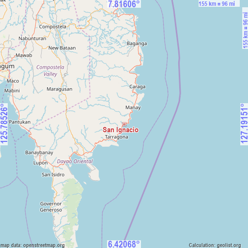
San Ignacio GPS coordinates[2]
7° 7' 8.04" North, 126° 29' 18.168" East
| Map corner | latitude | longitude |
|---|---|---|
| Upper-left | 7.81606°, | 125.78526° |
| Center: | 7.1189°, | 126.48838° |
| Lower-right: | 6.42068°, | 127.19151° |
| Map W x H: | 155.2×155.2 km | = 96.4×96.4mi |
| max Lat: | 20.78733° ⇑90.4% North |
| San Ignacio: | 7.1189° |
| min Lat: | ⇓9.6% South 4.65442° |
| min Long | San Ignacio | max Long |
| 117.04868° | 126.48838° | 126.58417° |
| W 99.8%⇐ | ⇒0.2% E |
Elevation
Elevation of San Ignacio is 22 m = 72 ft, and this is 65.9 m = 216 ft below average elevation for this country.
| Max E: |
2262 m = 7421 ft | 51.8% |
| Avg. | 87.9 m = 288 ft | |
| San Ignacio | 22 m = 72 ft | |
Min E: |
-2 m = -7 ft | 48.2% |
See also: Philippines elevation on elevation.city.
Geographical zone
San Ignacio is located in North Torrid zone (between Equator and Tropic of Cancer). Distance of Equator is 791.5 km =491.8 mi to South.| Distance of | km | miles | from San Ignacio |
|---|---|---|---|
| North Pole | 9215.5 | 5726.2 | to North |
| Arctic Circle | 6609.6 | 4107 | to North |
| Tropic Cancer | 1814.4 | 1127.4 | to North |
| Equator | 791.5 | 491.8 | to South |


Nearby cities:
15 places around San Ignacio: (largest is in red/bold)
• Baculin
38.6 km =24 mi,  15°
15°
• Bobon
33 km =20.5 mi,  212°
212°
• Caraga
25 km =15.5 mi, 20°
• Davan
43.4 km =27 mi,  238°
238°
• Jovellar
7.1 km =4.4 mi, 210°
• Limot
25.3 km =15.7 mi,  249°
249°
• Lukatan
14.2 km =8.8 mi, 211°
• Manay
12.1 km =7.5 mi,  27°
27°
• Mati
35.1 km =21.8 mi, 238°
• Mayo
21.6 km =13.4 mi,  233°
233°
• San Luis
36.5 km =22.7 mi,  10°
10°
• San Pedro
25 km =15.5 mi, 7°
• Santiago
21.1 km =13.1 mi, 26°
• Tamisan
37.1 km =23.1 mi, 214°
• Tarragona
9 km =5.6 mi, 210°
Sources, notices
• [Note1] Compared only with cities in Philippines existing in our database
• [Src1] Map data: © OpenStreetMap contributors (CC-BY-SA)
• [Src2] Other city data from geonames.org with taken over terms of usage.
• [Src3] Geographical zone / Annual Mean Temperature by Robert A. Rohde @ Wikipedia
