Bobon geodata
Bobon (Davao) is a populated place; located in Philippines in Asia/Manila (GMT+8) time zone. With population of 4,515 people, there are 1487 cities with bigger population in this country. Compared to other cities in Philippines, 92.8% of cities are located further ↑North; 99.4% of cities are located further ←West and 57.6% of cities have higher elevation than Bobon. Note1
Administrative division(s):
- Level 1: Davao
- Level 2: Province of Davao Oriental
- Level 3: City of Mati


Bobon GPS coordinates[2]
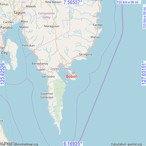
6° 52' 4.152" North, 126° 19' 42.168" East
| Map corner | latitude | longitude |
|---|---|---|
| Upper-left | 7.56537°, | 125.62526° |
| Center: | 6.86782°, | 126.32838° |
| Lower-right: | 6.16925°, | 127.03151° |
| Map W x H: | 155.2×155.2 km | = 96.4×96.4mi |
| max Lat: | 20.78733° ⇑92.8% North |
| Bobon: | 6.86782° |
| min Lat: | ⇓7.2% South 4.65442° |
| min Long | Bobon | max Long |
| 117.04868° | 126.32838° | 126.58417° |
| W 99.4%⇐ | ⇒0.59999999999999% E |
Elevation
Elevation of Bobon is 18 m = 59 ft, and this is 69.9 m = 229 ft below average elevation for this country.
| Max E: |
2262 m = 7421 ft | 57.6% |
| Avg. | 87.9 m = 288 ft | |
| Bobon | 18 m = 59 ft | |
Min E: |
-2 m = -7 ft | 42.4% |
See also: Philippines elevation on elevation.city.
Geographical zone
Bobon is located in North Torrid zone (between Equator and Tropic of Cancer). Distance of Equator is 763.6 km =474.5 mi to South.| Distance of | km | miles | from Bobon |
|---|---|---|---|
| North Pole | 9243.4 | 5743.6 | to North |
| Arctic Circle | 6637.5 | 4124.4 | to North |
| Tropic Cancer | 1842.3 | 1144.8 | to North |
| Equator | 763.6 | 474.5 | to South |


Nearby cities:
15 places around Bobon: (largest is in red/bold)
• Baon
27.7 km =17.2 mi,  253°
253°
• Batobato
27.3 km =17 mi,  260°
260°
• Bitaogan
29.8 km =18.5 mi, 248°
• Davan
20 km =12.4 mi,  285°
285°
• Ilangay
31.1 km =19.3 mi,  279°
279°
• Jovellar
25.9 km =16.1 mi,  32°
32°
• La Union
32.2 km =20 mi,  235°
235°
• Limot
20.2 km =12.6 mi,  342°
342°
• Lukatan
18.8 km =11.7 mi, 33°
• Manikling
29.6 km =18.4 mi,  272°
272°
• Mati
15.7 km =9.8 mi,  308°
308°
• Mayo
14.9 km =9.3 mi,  1°
1°
• Talisay
30.1 km =18.7 mi, 236°
• Tamisan
4.3 km =2.7 mi,  231°
231°
• Tarragona
24 km =14.9 mi, 33°
Sources, notices
• [Note1] Compared only with cities in Philippines existing in our database
• [Src1] Map data: © OpenStreetMap contributors (CC-BY-SA)
• [Src2] Other city data from geonames.org with taken over terms of usage.
• [Src3] Geographical zone / Annual Mean Temperature by Robert A. Rohde @ Wikipedia
