Sagud-Bahley geodata
Sagud-Bahley (Ilocos) is a populated place; located in Philippines in Asia/Manila (GMT+8) time zone. With population of 3,810 people, there are 1836 cities with bigger population in this country. Compared to other cities in Philippines, 88.8% of cities are located further ↓South; 94% of cities are located further →East and 89.7% of cities have higher elevation than Sagud-Bahley. Note1


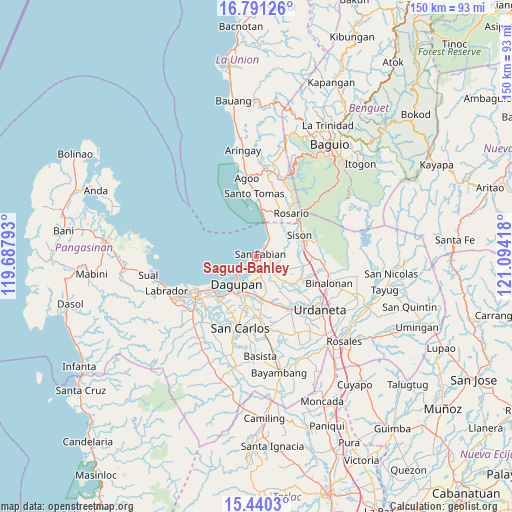
Sagud-Bahley GPS coordinates[2]
16° 7' 0.948" North, 120° 23' 27.78" East
| Map corner | latitude | longitude |
|---|---|---|
| Upper-left | 16.79126°, | 119.68793° |
| Center: | 16.11693°, | 120.39105° |
| Lower-right: | 15.4403°, | 121.09418° |
| Map W x H: | 150.2×150.2 km | = 93.3×93.3mi |
| max Lat: | 20.78733° ⇑11.2% North |
| Sagud-Bahley: | 16.11693° |
| min Lat: | ⇓88.8% South 4.65442° |
| min Long | Sagud-Bahley | max Long |
| 117.04868° | 120.39105° | 126.58417° |
| W 6%⇐ | ⇒94% E |
Elevation
Elevation of Sagud-Bahley is 7 m = 23 ft, and this is 80.9 m = 265 ft below average elevation for this country.
| Max E: |
2262 m = 7421 ft | 89.7% |
| Avg. | 87.9 m = 288 ft | |
| Sagud-Bahley | 7 m = 23 ft | |
Min E: |
-2 m = -7 ft | 10.3% |
See also: Philippines elevation on elevation.city.
Geographical zone
Sagud-Bahley is located in North Torrid zone (between Equator and Tropic of Cancer). Distance of this Northern Tropic circle is 813.9 km =505.7 mi to North.| Distance of | km | miles | from Sagud-Bahley |
|---|---|---|---|
| North Pole | 8215 | 5104.6 | to North |
| Arctic Circle | 5609.1 | 3485.3 | to North |
| Tropic Cancer | 813.9 | 505.7 | to North |
| Equator | 1792 | 1113.5 | to South |


Nearby cities:
15 places around Sagud-Bahley: (largest is in red/bold)
• Binday
6.7 km =4.2 mi,  79°
79°
• Calasiao
12.2 km =7.6 mi,  195°
195°
• Cayanga
0.8 km =0.5 mi,  104°
104°
• Dagupan
10.3 km =6.4 mi,  216°
216°
• Labney
8.1 km =5 mi, 101°
• Lobong
9.3 km =5.8 mi,  114°
114°
• Longos
1.2 km =0.7 mi,  151°
151°
• Mabilao
5.4 km =3.4 mi,  41°
41°
• Macayug
5.1 km =3.2 mi,  120°
120°
• Malanay
12.2 km =7.6 mi,  170°
170°
• Mangaldan
5.4 km =3.4 mi, 166°
• Nibaliw Central
1.7 km =1.1 mi,  46°
46°
• Nilombot
10.8 km =6.7 mi, 152°
• San Fabian
1.7 km =1.1 mi,  66°
66°
• San Jacinto
7.1 km =4.4 mi,  134°
134°
Sources, notices
• [Note1] Compared only with cities in Philippines existing in our database
• [Src1] Map data: © OpenStreetMap contributors (CC-BY-SA)
• [Src2] Other city data from geonames.org with taken over terms of usage.
• [Src3] Geographical zone / Annual Mean Temperature by Robert A. Rohde @ Wikipedia
