Liwan geodata
Liwan (Cordillera) is a populated place; located in Philippines in Asia/Manila (GMT+8) time zone. With population of 5,286 people, there are 1206 cities with bigger population in this country. Compared to other cities in Philippines, 96.2% of cities are located further ↓South; 65% of cities are located further →East and 73.8% of cities have lower elevation than Liwan. Note1


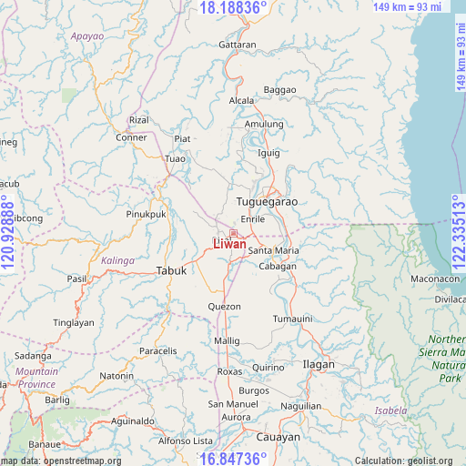
Liwan GPS coordinates[2]
17° 31' 8.76" North, 121° 37' 55.2" East
| Map corner | latitude | longitude |
|---|---|---|
| Upper-left | 18.18836°, | 120.92888° |
| Center: | 17.5191°, | 121.632° |
| Lower-right: | 16.84736°, | 122.33513° |
| Map W x H: | 149.1×149.1 km | = 92.6×92.6mi |
| max Lat: | 20.78733° ⇑3.8% North |
| Liwan: | 17.5191° |
| min Lat: | ⇓96.2% South 4.65442° |
| min Long | Liwan | max Long |
| 117.04868° | 121.632° | 126.58417° |
| W 35%⇐ | ⇒65% E |
Elevation
Elevation of Liwan is 64 m = 210 ft, and this is 23.9 m = 78 ft below average elevation for this country.
| Max E: |
2262 m = 7421 ft | 26.2% |
| Avg. | 87.9 m = 288 ft | |
| Liwan | 64 m = 210 ft | |
Min E: |
-2 m = -7 ft | 73.8% |
See also: Philippines elevation on elevation.city.
Geographical zone
Liwan is located in North Torrid zone (between Equator and Tropic of Cancer). Distance of this Northern Tropic circle is 658 km =408.9 mi to North.| Distance of | km | miles | from Liwan |
|---|---|---|---|
| North Pole | 8059.1 | 5007.7 | to North |
| Arctic Circle | 5453.2 | 3388.5 | to North |
| Tropic Cancer | 658 | 408.9 | to North |
| Equator | 1947.9 | 1210.4 | to South |


Nearby cities:
15 places around Liwan: (largest is in red/bold)
• Atulayan
17.5 km =10.9 mi,  21°
21°
• Bangad
15.6 km =9.7 mi,  99°
99°
• Cabagan
17.8 km =11.1 mi,  124°
124°
• Calamagui East
14.9 km =9.3 mi, 103°
• Divisoria
15.1 km =9.4 mi,  88°
88°
• Enrile
8.3 km =5.2 mi,  56°
56°
• Gadu
12.5 km =7.8 mi,  349°
349°
• Maddarulug Norte
10.9 km =6.8 mi,  25°
25°
• Magalalag
12.7 km =7.9 mi, 59°
• Mozzozzin Sur
13.9 km =8.6 mi, 119°
• San Juan
17.6 km =10.9 mi,  135°
135°
• Santa Maria
14 km =8.7 mi,  114°
114°
• Solana
16.1 km =10 mi, 22°
• Tuguegarao
14.4 km =8.9 mi,  41°
41°
• Ugac Sur
13.7 km =8.5 mi, 40°
Sources, notices
• [Note1] Compared only with cities in Philippines existing in our database
• [Src1] Map data: © OpenStreetMap contributors (CC-BY-SA)
• [Src2] Other city data from geonames.org with taken over terms of usage.
• [Src3] Geographical zone / Annual Mean Temperature by Robert A. Rohde @ Wikipedia
