Ragay geodata
Ragay (Bicol) is a seat of a third-order administrative division; located in Philippines in Asia/Manila (GMT+8) time zone. With population of 9,000 people, there are 688 cities with bigger population in this country. Compared to other cities in Philippines, 65.7% of cities are located further ↓South; 50.3% of cities are located further →East and 73.2% of cities have higher elevation than Ragay. Note1


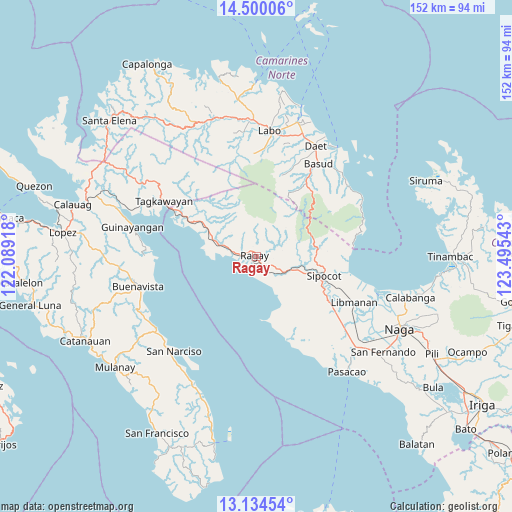
Ragay GPS coordinates[2]
13° 49' 5.88" North, 122° 47' 32.28" East
| Map corner | latitude | longitude |
|---|---|---|
| Upper-left | 14.50006°, | 122.08918° |
| Center: | 13.8183°, | 122.7923° |
| Lower-right: | 13.13454°, | 123.49543° |
| Map W x H: | 151.8×151.8 km | = 94.3×94.3mi |
| max Lat: | 20.78733° ⇑34.3% North |
| Ragay: | 13.8183° |
| min Lat: | ⇓65.7% South 4.65442° |
| min Long | Ragay | max Long |
| 117.04868° | 122.7923° | 126.58417° |
| W 49.7%⇐ | ⇒50.3% E |
Elevation
Elevation of Ragay is 11 m = 36 ft, and this is 76.9 m = 252 ft below average elevation for this country.
| Max E: |
2262 m = 7421 ft | 73.2% |
| Avg. | 87.9 m = 288 ft | |
| Ragay | 11 m = 36 ft | |
Min E: |
-2 m = -7 ft | 26.8% |
See also: Philippines elevation on elevation.city.
Geographical zone
Ragay is located in North Torrid zone (between Equator and Tropic of Cancer). Distance of this Northern Tropic circle is 1069.5 km =664.6 mi to North.| Distance of | km | miles | from Ragay |
|---|---|---|---|
| North Pole | 8470.6 | 5263.4 | to North |
| Arctic Circle | 5864.7 | 3644.2 | to North |
| Tropic Cancer | 1069.5 | 664.6 | to North |
| Equator | 1536.5 | 954.7 | to South |


Nearby cities:
15 places around Ragay: (largest is in red/bold)
• Apad
2.8 km =1.7 mi,  262°
262°
• Bao
20.1 km =12.5 mi,  167°
167°
• Bolo
20.1 km =12.5 mi,  111°
111°
• Catabangan
15.6 km =9.7 mi,  295°
295°
• Culacling
10 km =6.2 mi, 114°
• Del Gallego
24.2 km =15 mi, 298°
• Gambalidio
24.5 km =15.2 mi,  154°
154°
• Imelda
25.8 km =16 mi,  22°
22°
• Liboro
6.8 km =4.2 mi,  275°
275°
• Lubigan
17.8 km =11.1 mi,  118°
118°
• Lupi Viejo
13.1 km =8.1 mi,  104°
104°
• Sagurong
18.5 km =11.5 mi, 103°
• Sinuknipan
18.5 km =11.5 mi, 295°
• Sipocot
20.6 km =12.8 mi, 105°
• Tara
20.6 km =12.8 mi,  90°
90°
Sources, notices
• [Note1] Compared only with cities in Philippines existing in our database
• [Src1] Map data: © OpenStreetMap contributors (CC-BY-SA)
• [Src2] Other city data from geonames.org with taken over terms of usage.
• [Src3] Geographical zone / Annual Mean Temperature by Robert A. Rohde @ Wikipedia
