Catabangan geodata
Catabangan (Bicol) is a populated place; located in Philippines in Asia/Manila (GMT+8) time zone. With population of 3,665 people, there are 1936 cities with bigger population in this country. Compared to other cities in Philippines, 67% of cities are located further ↓South; 52% of cities are located further →East and 75.5% of cities have lower elevation than Catabangan. Note1


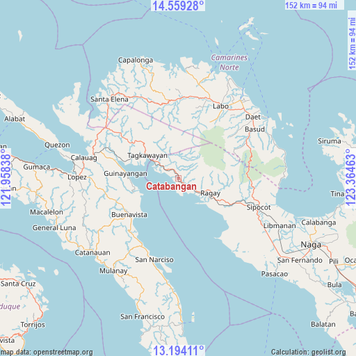
Catabangan GPS coordinates[2]
13° 52' 39.72" North, 122° 39' 41.4" East
| Map corner | latitude | longitude |
|---|---|---|
| Upper-left | 14.55928°, | 121.95838° |
| Center: | 13.8777°, | 122.6615° |
| Lower-right: | 13.19411°, | 123.36463° |
| Map W x H: | 151.8×151.8 km | = 94.3×94.3mi |
| max Lat: | 20.78733° ⇑33% North |
| Catabangan: | 13.8777° |
| min Lat: | ⇓67% South 4.65442° |
| min Long | Catabangan | max Long |
| 117.04868° | 122.6615° | 126.58417° |
| W 48%⇐ | ⇒52% E |
Elevation
Elevation of Catabangan is 70 m = 230 ft, and this is 17.9 m = 59 ft below average elevation for this country.
| Max E: |
2262 m = 7421 ft | 24.5% |
| Avg. | 87.9 m = 288 ft | |
| Catabangan | 70 m = 230 ft | |
Min E: |
-2 m = -7 ft | 75.5% |
See also: Philippines elevation on elevation.city.
Geographical zone
Catabangan is located in North Torrid zone (between Equator and Tropic of Cancer). Distance of this Northern Tropic circle is 1062.9 km =660.5 mi to North.| Distance of | km | miles | from Catabangan |
|---|---|---|---|
| North Pole | 8464 | 5259.3 | to North |
| Arctic Circle | 5858.1 | 3640.1 | to North |
| Tropic Cancer | 1062.9 | 660.5 | to North |
| Equator | 1543.1 | 958.8 | to South |


Nearby cities:
15 places around Catabangan: (largest is in red/bold)
• Apad
13.3 km =8.3 mi,  121°
121°
• Capuluan
17.2 km =10.7 mi,  246°
246°
• Culacling
25.6 km =15.9 mi,  114°
114°
• Del Gallego
8.7 km =5.4 mi,  304°
304°
• Guinayangan, Fourth District of Quezon
23.2 km =14.4 mi,  276°
276°
• Imelda
29.5 km =18.3 mi,  54°
54°
• Kinatakutan
22.6 km =14 mi,  292°
292°
• Liboro
9.4 km =5.8 mi,  128°
128°
• Lugui
29.8 km =18.5 mi,  28°
28°
• Lupi Viejo
28.5 km =17.7 mi, 110°
• Mapulot
21.7 km =13.5 mi,  322°
322°
• Ragay
15.6 km =9.7 mi, 115°
• Sinuknipan
2.9 km =1.8 mi, 296°
• Tagkawayan Sabang
19 km =11.8 mi,  311°
311°
• Tulay na Lupa
27.5 km =17.1 mi, 29°
Sources, notices
• [Note1] Compared only with cities in Philippines existing in our database
• [Src1] Map data: © OpenStreetMap contributors (CC-BY-SA)
• [Src2] Other city data from geonames.org with taken over terms of usage.
• [Src3] Geographical zone / Annual Mean Temperature by Robert A. Rohde @ Wikipedia
