Lubigan geodata
Lubigan (Bicol) is a populated place; located in Philippines in Asia/Manila (GMT+8) time zone. With population of 2,444 people, there are 3391 cities with bigger population in this country. Compared to other cities in Philippines, 64.9% of cities are located further ↓South; 52.2% of cities are located further ←West and 84% of cities have lower elevation than Lubigan. Note1


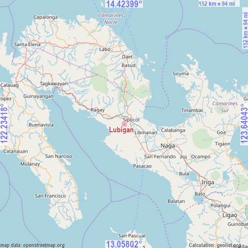
Lubigan GPS coordinates[2]
13° 44' 31.2" North, 122° 56' 14.28" East
| Map corner | latitude | longitude |
|---|---|---|
| Upper-left | 14.42399°, | 122.23418° |
| Center: | 13.742°, | 122.9373° |
| Lower-right: | 13.05802°, | 123.64043° |
| Map W x H: | 151.9×151.9 km | = 94.4×94.4mi |
| max Lat: | 20.78733° ⇑35.1% North |
| Lubigan: | 13.742° |
| min Lat: | ⇓64.9% South 4.65442° |
| min Long | Lubigan | max Long |
| 117.04868° | 122.9373° | 126.58417° |
| W 52.2%⇐ | ⇒47.8% E |
Elevation
Elevation of Lubigan is 125 m = 410 ft, and this is 37.1 m = 122 ft above average elevation for this country.
| Max E: |
2262 m = 7421 ft | 16% |
| Lubigan | 125 m 410 ft | |
| Avg. | 87.9 m = 288 ft | |
Min E: |
-2 m = -7 ft | 84% |
See also: Philippines elevation on elevation.city.
Geographical zone
Lubigan is located in North Torrid zone (between Equator and Tropic of Cancer). Distance of this Northern Tropic circle is 1078 km =669.8 mi to North.| Distance of | km | miles | from Lubigan |
|---|---|---|---|
| North Pole | 8479.1 | 5268.7 | to North |
| Arctic Circle | 5873.2 | 3649.4 | to North |
| Tropic Cancer | 1078 | 669.8 | to North |
| Equator | 1528 | 949.5 | to South |


Nearby cities:
15 places around Lubigan: (largest is in red/bold)
• Bao
16 km =9.9 mi,  225°
225°
• Barcelona
12.4 km =7.7 mi,  74°
74°
• Bolo
3.3 km =2.1 mi, 68°
• Culacling
7.9 km =4.9 mi,  303°
303°
• Gambalidio
14.4 km =8.9 mi,  200°
200°
• Libmanan
14.3 km =8.9 mi,  112°
112°
• Lupi Viejo
6.1 km =3.8 mi,  330°
330°
• Mambulo
12.5 km =7.8 mi,  103°
103°
• Pandan
15.6 km =9.7 mi,  89°
89°
• Ragay
17.8 km =11.1 mi, 298°
• Sagurong
4.9 km =3 mi,  29°
29°
• San Ramon
17.6 km =10.9 mi,  141°
141°
• Sipocot
5.1 km =3.2 mi,  55°
55°
• Tara
9.7 km =6 mi, 30°
• Tinalmud
17.6 km =10.9 mi, 201°
Sources, notices
• [Note1] Compared only with cities in Philippines existing in our database
• [Src1] Map data: © OpenStreetMap contributors (CC-BY-SA)
• [Src2] Other city data from geonames.org with taken over terms of usage.
• [Src3] Geographical zone / Annual Mean Temperature by Robert A. Rohde @ Wikipedia
