Puerto Galera geodata
Puerto Galera (Mimaropa) is a populated place; located in Philippines in Asia/Manila (GMT+8) time zone. With population of 3,274 people, there are 2237 cities with bigger population in this country. Compared to other cities in Philippines, 62.2% of cities are located further ↓South; 77.7% of cities are located further →East and 70.2% of cities have higher elevation than Puerto Galera. Note1
Administrative division(s):
- Level 1: Mimaropa
- Level 2: Province of Mindoro Oriental
- Level 3: Puerto Galera


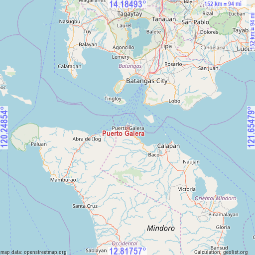
Puerto Galera GPS coordinates[2]
13° 30' 8.028" North, 120° 57' 5.976" East
| Map corner | latitude | longitude |
|---|---|---|
| Upper-left | 14.18493°, | 120.24854° |
| Center: | 13.50223°, | 120.95166° |
| Lower-right: | 12.81757°, | 121.65479° |
| Map W x H: | 152×152 km | = 94.4×94.4mi |
| max Lat: | 20.78733° ⇑37.8% North |
| Puerto Galera: | 13.50223° |
| min Lat: | ⇓62.2% South 4.65442° |
| min Long | Puerto Galera | max Long |
| 117.04868° | 120.95166° | 126.58417° |
| W 22.3%⇐ | ⇒77.7% E |
Elevation
Elevation of Puerto Galera is 12 m = 39 ft, and this is 75.9 m = 249 ft below average elevation for this country.
| Max E: |
2262 m = 7421 ft | 70.2% |
| Avg. | 87.9 m = 288 ft | |
| Puerto Galera | 12 m = 39 ft | |
Min E: |
-2 m = -7 ft | 29.8% |
See also: Philippines elevation on elevation.city.
Geographical zone
Puerto Galera is located in North Torrid zone (between Equator and Tropic of Cancer). Distance of this Northern Tropic circle is 1104.6 km =686.4 mi to North.| Distance of | km | miles | from Puerto Galera |
|---|---|---|---|
| North Pole | 8505.8 | 5285.3 | to North |
| Arctic Circle | 5899.9 | 3666 | to North |
| Tropic Cancer | 1104.6 | 686.4 | to North |
| Equator | 1501.3 | 932.9 | to South |


Nearby cities:
15 places around Puerto Galera: (largest is in red/bold)
• Abra de Ilog
24.9 km =15.5 mi,  254°
254°
• Baco
22.6 km =14 mi,  135°
135°
• Bagalangit
24.3 km =15.1 mi,  342°
342°
• Balatero
2.9 km =1.8 mi,  269°
269°
• Dulangan
4.9 km =3 mi, 140°
• Evangelista
24.5 km =15.2 mi, 140°
• Ilihan
19.3 km =12 mi,  41°
41°
• Lumangbayan
12.9 km =8 mi, 135°
• Odala
14.3 km =8.9 mi,  258°
258°
• Sabang
2.5 km =1.6 mi,  71°
71°
• San Teodoro
10.2 km =6.3 mi, 138°
• Tabinay
1.8 km =1.1 mi,  162°
162°
• Tacligan
16.7 km =10.4 mi,  134°
134°
• Tingloy
19.7 km =12.2 mi,  333°
333°
• Wawa
22.9 km =14.2 mi, 259°
Sources, notices
• [Note1] Compared only with cities in Philippines existing in our database
• [Src1] Map data: © OpenStreetMap contributors (CC-BY-SA)
• [Src2] Other city data from geonames.org with taken over terms of usage.
• [Src3] Geographical zone / Annual Mean Temperature by Robert A. Rohde @ Wikipedia
