Balatero geodata
Balatero (Mimaropa) is a populated place; located in Philippines in Asia/Manila (GMT+8) time zone. With population of 3,746 people, there are 1883 cities with bigger population in this country. Compared to other cities in Philippines, 62.2% of cities are located further ↓South; 78.6% of cities are located further →East and 78.7% of cities have lower elevation than Balatero. Note1
Administrative division(s):
- Level 1: Mimaropa
- Level 2: Province of Mindoro Oriental
- Level 3: Puerto Galera


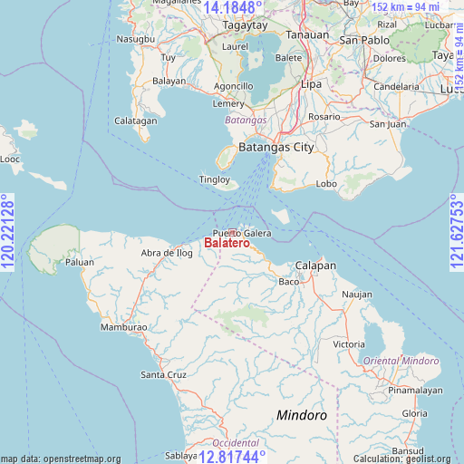
Balatero GPS coordinates[2]
13° 30' 7.56" North, 120° 55' 27.84" East
| Map corner | latitude | longitude |
|---|---|---|
| Upper-left | 14.1848°, | 120.22128° |
| Center: | 13.5021°, | 120.9244° |
| Lower-right: | 12.81744°, | 121.62753° |
| Map W x H: | 152×152 km | = 94.4×94.4mi |
| max Lat: | 20.78733° ⇑37.8% North |
| Balatero: | 13.5021° |
| min Lat: | ⇓62.2% South 4.65442° |
| min Long | Balatero | max Long |
| 117.04868° | 120.9244° | 126.58417° |
| W 21.4%⇐ | ⇒78.6% E |
Elevation
Elevation of Balatero is 84 m = 276 ft, and this is 3.9 m = 13 ft below average elevation for this country.
| Max E: |
2262 m = 7421 ft | 21.3% |
| Avg. | 87.9 m = 288 ft | |
| Balatero | 84 m = 276 ft | |
Min E: |
-2 m = -7 ft | 78.7% |
See also: Philippines elevation on elevation.city.
Geographical zone
Balatero is located in North Torrid zone (between Equator and Tropic of Cancer). Distance of this Northern Tropic circle is 1104.6 km =686.4 mi to North.| Distance of | km | miles | from Balatero |
|---|---|---|---|
| North Pole | 8505.8 | 5285.3 | to North |
| Arctic Circle | 5899.9 | 3666 | to North |
| Tropic Cancer | 1104.6 | 686.4 | to North |
| Equator | 1501.3 | 932.9 | to South |


Nearby cities:
15 places around Balatero: (largest is in red/bold)
• Abra de Ilog
22.1 km =13.7 mi,  252°
252°
• Baco
24.8 km =15.4 mi,  130°
130°
• Bagalangit
23.6 km =14.7 mi,  349°
349°
• Dulangan
7.1 km =4.4 mi,  121°
121°
• Ilihan
21.4 km =13.3 mi,  47°
47°
• Lumangbayan
15.1 km =9.4 mi, 127°
• Odala
11.4 km =7.1 mi,  256°
256°
• Puerto Galera
2.9 km =1.8 mi,  89°
89°
• Sabang
5.4 km =3.4 mi,  81°
81°
• San Teodoro
12.4 km =7.7 mi, 128°
• Tabinay
3.9 km =2.4 mi, 115°
• Tacligan
18.9 km =11.7 mi, 127°
• Talaga
26.1 km =16.2 mi,  2°
2°
• Tingloy
18.6 km =11.6 mi,  341°
341°
• Wawa
20 km =12.4 mi, 257°
Sources, notices
• [Note1] Compared only with cities in Philippines existing in our database
• [Src1] Map data: © OpenStreetMap contributors (CC-BY-SA)
• [Src2] Other city data from geonames.org with taken over terms of usage.
• [Src3] Geographical zone / Annual Mean Temperature by Robert A. Rohde @ Wikipedia
