Bagalangit geodata
Bagalangit (Calabarzon) is a section of populated place; located in Philippines in Asia/Manila (GMT+8) time zone. With population of 2,401 people, there are 3463 cities with bigger population in this country. Compared to other cities in Philippines, 64.5% of cities are located further ↓South; 79.8% of cities are located further →East and 90.7% of cities have lower elevation than Bagalangit. Note1


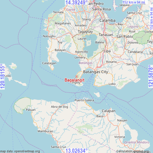
Bagalangit GPS coordinates[2]
13° 42' 37.476" North, 120° 53' 4.812" East
| Map corner | latitude | longitude |
|---|---|---|
| Upper-left | 14.39249°, | 120.18155° |
| Center: | 13.71041°, | 120.88467° |
| Lower-right: | 13.02634°, | 121.5878° |
| Map W x H: | 151.9×151.9 km | = 94.4×94.4mi |
| max Lat: | 20.78733° ⇑35.5% North |
| Bagalangit: | 13.71041° |
| min Lat: | ⇓64.5% South 4.65442° |
| min Long | Bagalangit | max Long |
| 117.04868° | 120.88467° | 126.58417° |
| W 20.2%⇐ | ⇒79.8% E |
Elevation
Elevation of Bagalangit is 241 m = 791 ft, and this is 153.1 m = 502 ft above average elevation for this country.
| Max E: |
2262 m = 7421 ft | 9.3% |
| Bagalangit | 241 m 791 ft | |
| Avg. | 87.9 m = 288 ft | |
Min E: |
-2 m = -7 ft | 90.7% |
See also: Philippines elevation on elevation.city.
Geographical zone
Bagalangit is located in North Torrid zone (between Equator and Tropic of Cancer). Distance of this Northern Tropic circle is 1081.5 km =672 mi to North.| Distance of | km | miles | from Bagalangit |
|---|---|---|---|
| North Pole | 8482.6 | 5270.8 | to North |
| Arctic Circle | 5876.7 | 3651.6 | to North |
| Tropic Cancer | 1081.5 | 672 | to North |
| Equator | 1524.5 | 947.3 | to South |


Nearby cities:
15 places around Bagalangit: (largest is in red/bold)
• Bauan
16.1 km =10 mi,  55°
55°
• Bolo
13.7 km =8.5 mi,  49°
49°
• Calumpang
17.7 km =11 mi,  33°
33°
• Inicbulan
16.2 km =10.1 mi,  41°
41°
• Lemery
19.2 km =11.9 mi,  9°
9°
• Mabini
7.7 km =4.8 mi, 51°
• San Jose
17.2 km =10.7 mi,  23°
23°
• San Luis
16.4 km =10.2 mi, 12°
• San Pascual
18.5 km =11.5 mi, 53°
• Santa Rita Aplaya
17.6 km =10.9 mi,  67°
67°
• Sinala
14.4 km =8.9 mi, 42°
• Solo
4.4 km =2.7 mi, 23°
• Talaga
6.3 km =3.9 mi, 62°
• Tingloy
5.7 km =3.5 mi,  194°
194°
• Wawa
18.5 km =11.5 mi,  79°
79°
Sources, notices
• [Note1] Compared only with cities in Philippines existing in our database
• [Src1] Map data: © OpenStreetMap contributors (CC-BY-SA)
• [Src2] Other city data from geonames.org with taken over terms of usage.
• [Src3] Geographical zone / Annual Mean Temperature by Robert A. Rohde @ Wikipedia
