Tingloy geodata
Tingloy (Calabarzon) is a seat of a third-order administrative division; located in Philippines in Asia/Manila (GMT+8) time zone. With population of 2,646 people, there are 3032 cities with bigger population in this country. Compared to other cities in Philippines, 64.1% of cities are located further ↓South; 80.3% of cities are located further →East and 67.4% of cities have higher elevation than Tingloy. Note1


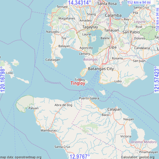
Tingloy GPS coordinates[2]
13° 39' 39.276" North, 120° 52' 15.96" East
| Map corner | latitude | longitude |
|---|---|---|
| Upper-left | 14.34314°, | 120.16798° |
| Center: | 13.66091°, | 120.8711° |
| Lower-right: | 12.9767°, | 121.57423° |
| Map W x H: | 151.9×151.9 km | = 94.4×94.4mi |
| max Lat: | 20.78733° ⇑35.9% North |
| Tingloy: | 13.66091° |
| min Lat: | ⇓64.1% South 4.65442° |
| min Long | Tingloy | max Long |
| 117.04868° | 120.8711° | 126.58417° |
| W 19.7%⇐ | ⇒80.3% E |
Elevation
Elevation of Tingloy is 13 m = 43 ft, and this is 74.9 m = 246 ft below average elevation for this country.
| Max E: |
2262 m = 7421 ft | 67.4% |
| Avg. | 87.9 m = 288 ft | |
| Tingloy | 13 m = 43 ft | |
Min E: |
-2 m = -7 ft | 32.6% |
See also: Philippines elevation on elevation.city.
Geographical zone
Tingloy is located in North Torrid zone (between Equator and Tropic of Cancer). Distance of this Northern Tropic circle is 1087 km =675.4 mi to North.| Distance of | km | miles | from Tingloy |
|---|---|---|---|
| North Pole | 8488.1 | 5274.3 | to North |
| Arctic Circle | 5882.2 | 3655 | to North |
| Tropic Cancer | 1087 | 675.4 | to North |
| Equator | 1519 | 943.9 | to South |


Nearby cities:
15 places around Tingloy: (largest is in red/bold)
• Bagalangit
5.7 km =3.5 mi,  14°
14°
• Balatero
18.6 km =11.6 mi,  161°
161°
• Bauan
20.8 km =12.9 mi,  45°
45°
• Bolo
18.7 km =11.6 mi,  39°
39°
• Inicbulan
21.5 km =13.4 mi,  34°
34°
• Mabini
12.7 km =7.9 mi, 36°
• Odala
21.1 km =13.1 mi,  194°
194°
• Puerto Galera
19.7 km =12.2 mi,  153°
153°
• Sabang
20.2 km =12.6 mi, 146°
• Santa Rita Aplaya
21.6 km =13.4 mi,  55°
55°
• Sinala
19.6 km =12.2 mi, 34°
• Solo
10.1 km =6.3 mi,  18°
18°
• Tabinay
21.4 km =13.3 mi, 154°
• Talaga
11 km =6.8 mi, 39°
• Wawa
21.5 km =13.4 mi,  65°
65°
Sources, notices
• [Note1] Compared only with cities in Philippines existing in our database
• [Src1] Map data: © OpenStreetMap contributors (CC-BY-SA)
• [Src2] Other city data from geonames.org with taken over terms of usage.
• [Src3] Geographical zone / Annual Mean Temperature by Robert A. Rohde @ Wikipedia
