Santo Niño geodata
Santo Niño (Cagayan Valley) is a seat of a third-order administrative division; located in Philippines in Asia/Manila (GMT+8) time zone. With population of 4,915 people, there are 1329 cities with bigger population in this country. Compared to other cities in Philippines, 97.9% of cities are located further ↓South; 65.7% of cities are located further →East and 51.8% of cities have higher elevation than Santo Niño. Note1
Administrative division(s):
- Level 1: Cagayan Valley
- Level 2: Province of Cagayan
- Level 3: Santo Niño (Faire)


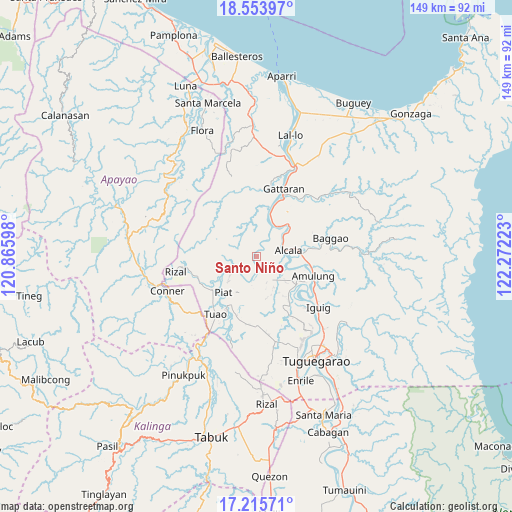
Santo Niño GPS coordinates[2]
17° 53' 9.96" North, 121° 34' 8.76" East
| Map corner | latitude | longitude |
|---|---|---|
| Upper-left | 18.55397°, | 120.86598° |
| Center: | 17.8861°, | 121.5691° |
| Lower-right: | 17.21571°, | 122.27223° |
| Map W x H: | 148.8×148.8 km | = 92.5×92.5mi |
| max Lat: | 20.78733° ⇑2.1% North |
| Santo Niño: | 17.8861° |
| min Lat: | ⇓97.9% South 4.65442° |
| min Long | Santo Niño | max Long |
| 117.04868° | 121.5691° | 126.58417° |
| W 34.3%⇐ | ⇒65.7% E |
Elevation
Elevation of Santo Niño is 22 m = 72 ft, and this is 65.9 m = 216 ft below average elevation for this country.
| Max E: |
2262 m = 7421 ft | 51.8% |
| Avg. | 87.9 m = 288 ft | |
| Santo Niño | 22 m = 72 ft | |
Min E: |
-2 m = -7 ft | 48.2% |
See also: Philippines elevation on elevation.city.
Geographical zone
Santo Niño is located in North Torrid zone (between Equator and Tropic of Cancer). Distance of this Northern Tropic circle is 617.2 km =383.5 mi to North.| Distance of | km | miles | from Santo Niño |
|---|---|---|---|
| North Pole | 8018.3 | 4982.3 | to North |
| Arctic Circle | 5412.4 | 3363.1 | to North |
| Tropic Cancer | 617.2 | 383.5 | to North |
| Equator | 1988.7 | 1235.7 | to South |


Nearby cities:
15 places around Santo Niño: (largest is in red/bold)
• Accusilian
19.1 km =11.9 mi,  216°
216°
• Afusing Centro
7.2 km =4.5 mi,  121°
121°
• Alabug
20.2 km =12.6 mi,  212°
212°
• Alannay
19.5 km =12.1 mi,  5°
5°
• Alcala
9.4 km =5.8 mi,  79°
79°
• Amulung
17.3 km =10.7 mi,  108°
108°
• Calantac
16.5 km =10.3 mi, 81°
• Dalaoig
16.9 km =10.5 mi,  65°
65°
• Estefania
18.9 km =11.7 mi, 120°
• Lasam
20.2 km =12.6 mi, 9°
• Maguilling
15 km =9.3 mi, 210°
• Pata
20.3 km =12.6 mi,  200°
200°
• Piat
14.4 km =8.9 mi, 222°
• Tuao
20.5 km =12.7 mi, 215°
• Tupang
7.9 km =4.9 mi, 74°
Sources, notices
• [Note1] Compared only with cities in Philippines existing in our database
• [Src1] Map data: © OpenStreetMap contributors (CC-BY-SA)
• [Src2] Other city data from geonames.org with taken over terms of usage.
• [Src3] Geographical zone / Annual Mean Temperature by Robert A. Rohde @ Wikipedia
