Pasuquin geodata
Pasuquin (Ilocos) is a seat of a third-order administrative division; located in Philippines in Asia/Manila (GMT+8) time zone. With population of 5,768 people, there are 1097 cities with bigger population in this country. Compared to other cities in Philippines, 99.4% of cities are located further ↓South; 87.5% of cities are located further →East and 70.2% of cities have higher elevation than Pasuquin. Note1


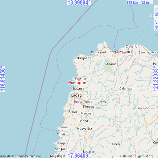
Pasuquin GPS coordinates[2]
18° 19' 58.08" North, 120° 37' 3.72" East
| Map corner | latitude | longitude |
|---|---|---|
| Upper-left | 18.99894°, | 119.91458° |
| Center: | 18.3328°, | 120.6177° |
| Lower-right: | 17.66409°, | 121.32083° |
| Map W x H: | 148.4×148.4 km | = 92.2×92.2mi |
| max Lat: | 20.78733° ⇑0.6% North |
| Pasuquin: | 18.3328° |
| min Lat: | ⇓99.4% South 4.65442° |
| min Long | Pasuquin | max Long |
| 117.04868° | 120.6177° | 126.58417° |
| W 12.5%⇐ | ⇒87.5% E |
Elevation
Elevation of Pasuquin is 12 m = 39 ft, and this is 75.9 m = 249 ft below average elevation for this country.
| Max E: |
2262 m = 7421 ft | 70.2% |
| Avg. | 87.9 m = 288 ft | |
| Pasuquin | 12 m = 39 ft | |
Min E: |
-2 m = -7 ft | 29.8% |
See also: Philippines elevation on elevation.city.
Geographical zone
Pasuquin is located in North Torrid zone (between Equator and Tropic of Cancer). Distance of this Northern Tropic circle is 567.5 km =352.6 mi to North.| Distance of | km | miles | from Pasuquin |
|---|---|---|---|
| North Pole | 7968.6 | 4951.5 | to North |
| Arctic Circle | 5362.8 | 3332.3 | to North |
| Tropic Cancer | 567.5 | 352.6 | to North |
| Equator | 2038.4 | 1266.6 | to South |


Nearby cities:
15 places around Pasuquin: (largest is in red/bold)
• Baay
24.2 km =15 mi,  190°
190°
• Bacarra
8.9 km =5.5 mi,  183°
183°
• Bangui
27.7 km =17.2 mi,  34°
34°
• Bil-Loca
27.8 km =17.3 mi, 190°
• Burgos
20.6 km =12.8 mi,  7°
7°
• Davila
16.1 km =10 mi,  344°
344°
• Dingras
26.9 km =16.7 mi,  161°
161°
• Dumalneg
29.5 km =18.3 mi,  43°
43°
• Laoag
15.2 km =9.4 mi, 188°
• Nagbacalan
26.1 km =16.2 mi,  202°
202°
• Piddig
21.4 km =13.3 mi,  150°
150°
• San Lorenzo
22.3 km =13.9 mi, 176°
• San Nicolas
18 km =11.2 mi, 187°
• Sarrat
19.7 km =12.2 mi,  170°
170°
• Vintar
12 km =7.5 mi, 164°
Sources, notices
• [Note1] Compared only with cities in Philippines existing in our database
• [Src1] Map data: © OpenStreetMap contributors (CC-BY-SA)
• [Src2] Other city data from geonames.org with taken over terms of usage.
• [Src3] Geographical zone / Annual Mean Temperature by Robert A. Rohde @ Wikipedia
