Bangui geodata
Bangui (Ilocos) is a seat of a third-order administrative division; located in Philippines in Asia/Manila (GMT+8) time zone. With population of 2,458 people, there are 3366 cities with bigger population in this country. Compared to other cities in Philippines, 99.8% of cities are located further ↓South; 83.2% of cities are located further →East and 67.4% of cities have higher elevation than Bangui. Note1


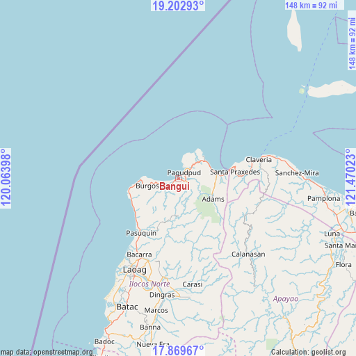
Bangui GPS coordinates[2]
18° 32' 15.36" North, 120° 46' 1.56" East
| Map corner | latitude | longitude |
|---|---|---|
| Upper-left | 19.20293°, | 120.06398° |
| Center: | 18.5376°, | 120.7671° |
| Lower-right: | 17.86967°, | 121.47023° |
| Map W x H: | 148.2×148.2 km | = 92.1×92.1mi |
| max Lat: | 20.78733° ⇑0.2% North |
| Bangui: | 18.5376° |
| min Lat: | ⇓99.8% South 4.65442° |
| min Long | Bangui | max Long |
| 117.04868° | 120.7671° | 126.58417° |
| W 16.8%⇐ | ⇒83.2% E |
Elevation
Elevation of Bangui is 13 m = 43 ft, and this is 74.9 m = 246 ft below average elevation for this country.
| Max E: |
2262 m = 7421 ft | 67.4% |
| Avg. | 87.9 m = 288 ft | |
| Bangui | 13 m = 43 ft | |
Min E: |
-2 m = -7 ft | 32.6% |
See also: Philippines elevation on elevation.city.
Geographical zone
Bangui is located in North Torrid zone (between Equator and Tropic of Cancer). Distance of this Northern Tropic circle is 544.7 km =338.5 mi to North.| Distance of | km | miles | from Bangui |
|---|---|---|---|
| North Pole | 7945.9 | 4937.4 | to North |
| Arctic Circle | 5340 | 3318.1 | to North |
| Tropic Cancer | 544.7 | 338.5 | to North |
| Equator | 2061.2 | 1280.8 | to South |


Nearby cities:
15 places around Bangui: (largest is in red/bold)
• Adams
16.1 km =10 mi,  119°
119°
• Bacarra
35.6 km =22.1 mi,  207°
207°
• Burgos
13.1 km =8.1 mi,  259°
259°
• Calanasan
42.2 km =26.2 mi,  138°
138°
• Carasi
39.1 km =24.3 mi,  164°
164°
• Claveria
34.2 km =21.3 mi,  76°
76°
• Davila
21.4 km =13.3 mi,  250°
250°
• Dumalneg
4.7 km =2.9 mi,  106°
106°
• Laoag
41.9 km =26 mi, 205°
• Namuac
42.8 km =26.6 mi, 79°
• Pagudpud
3.4 km =2.1 mi,  37°
37°
• Pasuquin
27.7 km =17.2 mi, 214°
• Piddig
41.7 km =25.9 mi,  187°
187°
• Santa Praxedes
24.8 km =15.4 mi, 82°
• Vintar
36.6 km =22.7 mi,  200°
200°
Sources, notices
• [Note1] Compared only with cities in Philippines existing in our database
• [Src1] Map data: © OpenStreetMap contributors (CC-BY-SA)
• [Src2] Other city data from geonames.org with taken over terms of usage.
• [Src3] Geographical zone / Annual Mean Temperature by Robert A. Rohde @ Wikipedia
