Parista geodata
Parista (Central Luzon) is a populated place; located in Philippines in Asia/Manila (GMT+8) time zone. With population of 3,515 people, there are 2044 cities with bigger population in this country. Compared to other cities in Philippines, 85.6% of cities are located further ↓South; 78.5% of cities are located further →East and 84.9% of cities have lower elevation than Parista. Note1


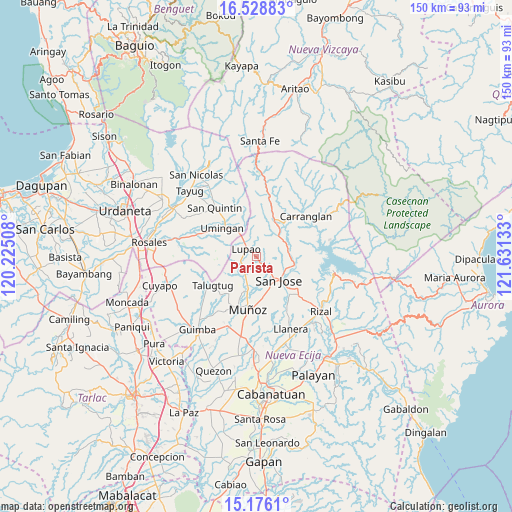
Parista GPS coordinates[2]
15° 51' 12.96" North, 120° 55' 41.52" East
| Map corner | latitude | longitude |
|---|---|---|
| Upper-left | 16.52883°, | 120.22508° |
| Center: | 15.8536°, | 120.9282° |
| Lower-right: | 15.1761°, | 121.63133° |
| Map W x H: | 150.4×150.4 km | = 93.5×93.5mi |
| max Lat: | 20.78733° ⇑14.4% North |
| Parista: | 15.8536° |
| min Lat: | ⇓85.6% South 4.65442° |
| min Long | Parista | max Long |
| 117.04868° | 120.9282° | 126.58417° |
| W 21.5%⇐ | ⇒78.5% E |
Elevation
Elevation of Parista is 137 m = 449 ft, and this is 49.1 m = 161 ft above average elevation for this country.
| Max E: |
2262 m = 7421 ft | 15.1% |
| Parista | 137 m 449 ft | |
| Avg. | 87.9 m = 288 ft | |
Min E: |
-2 m = -7 ft | 84.9% |
See also: Philippines elevation on elevation.city.
Geographical zone
Parista is located in North Torrid zone (between Equator and Tropic of Cancer). Distance of this Northern Tropic circle is 843.2 km =523.9 mi to North.| Distance of | km | miles | from Parista |
|---|---|---|---|
| North Pole | 8244.3 | 5122.8 | to North |
| Arctic Circle | 5638.4 | 3503.5 | to North |
| Tropic Cancer | 843.2 | 523.9 | to North |
| Equator | 1762.8 | 1095.4 | to South |


Nearby cities:
15 places around Parista: (largest is in red/bold)
• Diaz
10 km =6.2 mi,  265°
265°
• Digdig
11.9 km =7.4 mi,  26°
26°
• Lupao
4.3 km =2.7 mi,  311°
311°
• Magtangol
10.7 km =6.6 mi,  187°
187°
• Muñoz
15.5 km =9.6 mi, 189°
• Nancalobasaan
12.8 km =8 mi, 314°
• Puncan
8.9 km =5.5 mi,  48°
48°
• Salvacion I
2 km =1.2 mi,  220°
220°
• Sampaloc
7.8 km =4.8 mi,  238°
238°
• Santo Tomas
12.1 km =7.5 mi,  162°
162°
• Sibul
9.7 km =6 mi,  127°
127°
• Talugtug
15.1 km =9.4 mi, 236°
• Tayabo
11.2 km =7 mi,  100°
100°
• Umingan
14.8 km =9.2 mi,  290°
290°
• Villa Isla
11.4 km =7.1 mi, 215°
Sources, notices
• [Note1] Compared only with cities in Philippines existing in our database
• [Src1] Map data: © OpenStreetMap contributors (CC-BY-SA)
• [Src2] Other city data from geonames.org with taken over terms of usage.
• [Src3] Geographical zone / Annual Mean Temperature by Robert A. Rohde @ Wikipedia
