Talugtug geodata
Talugtug (Central Luzon) is a populated place; located in Philippines in Asia/Manila (GMT+8) time zone. With population of 6,307 people, there are 991 cities with bigger population in this country. Compared to other cities in Philippines, 84.6% of cities are located further ↓South; 82% of cities are located further →East and 79.9% of cities have lower elevation than Talugtug. Note1
Administrative division(s):
- Level 1: Central Luzon
- Level 2: Province of Nueva Ecija
- Level 3: Talugtug


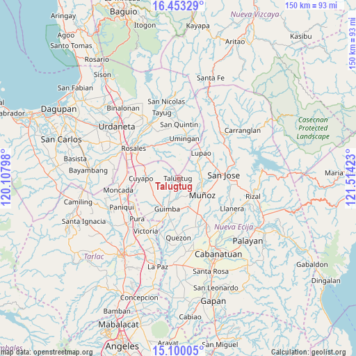
Talugtug GPS coordinates[2]
15° 46' 40.08" North, 120° 48' 39.96" East
| Map corner | latitude | longitude |
|---|---|---|
| Upper-left | 16.45329°, | 120.10798° |
| Center: | 15.7778°, | 120.8111° |
| Lower-right: | 15.10005°, | 121.51423° |
| Map W x H: | 150.5×150.5 km | = 93.5×93.5mi |
| max Lat: | 20.78733° ⇑15.4% North |
| Talugtug: | 15.7778° |
| min Lat: | ⇓84.6% South 4.65442° |
| min Long | Talugtug | max Long |
| 117.04868° | 120.8111° | 126.58417° |
| W 18%⇐ | ⇒82% E |
Elevation
Elevation of Talugtug is 91 m = 299 ft, and this is 3.1 m = 10 ft above average elevation for this country.
| Max E: |
2262 m = 7421 ft | 20.1% |
| Talugtug | 91 m 299 ft | |
| Avg. | 87.9 m = 288 ft | |
Min E: |
-2 m = -7 ft | 79.9% |
See also: Philippines elevation on elevation.city.
Geographical zone
Talugtug is located in North Torrid zone (between Equator and Tropic of Cancer). Distance of this Northern Tropic circle is 851.6 km =529.2 mi to North.| Distance of | km | miles | from Talugtug |
|---|---|---|---|
| North Pole | 8252.7 | 5128 | to North |
| Arctic Circle | 5646.8 | 3508.8 | to North |
| Tropic Cancer | 851.6 | 529.2 | to North |
| Equator | 1754.3 | 1090.1 | to South |


Nearby cities:
15 places around Talugtug: (largest is in red/bold)
• Baloy
5 km =3.1 mi,  307°
307°
• Bunol
12.6 km =7.8 mi,  168°
168°
• Cavite
12 km =7.5 mi,  201°
201°
• Diaz
8 km =5 mi,  18°
18°
• Lennec
13.4 km =8.3 mi,  218°
218°
• Magtangol
11.4 km =7.1 mi,  101°
101°
• Maturanoc
13.6 km =8.5 mi,  188°
188°
• Muñoz
12 km =7.5 mi,  124°
124°
• Paitan Norte
9.7 km =6 mi, 309°
• Palusapis
11.9 km =7.4 mi,  152°
152°
• Salvacion I
13.2 km =8.2 mi,  58°
58°
• Sampaloc
7.4 km =4.6 mi,  53°
53°
• San Andres
7.4 km =4.6 mi,  208°
208°
• Umingan
13.7 km =8.5 mi,  354°
354°
• Villa Isla
6 km =3.7 mi, 97°
Sources, notices
• [Note1] Compared only with cities in Philippines existing in our database
• [Src1] Map data: © OpenStreetMap contributors (CC-BY-SA)
• [Src2] Other city data from geonames.org with taken over terms of usage.
• [Src3] Geographical zone / Annual Mean Temperature by Robert A. Rohde @ Wikipedia
